The Ramparts
Hillsborough is the best surviving example of a ‘Promontory fort’ in North Devon. As the name suggests, these hillforts cut off spurs of land by making use of the natural defence provided by steep-sided cliffs. Hillsborough’s double line of ramparts may have stretched all the way across from Ilfracombe harbour in the west to Hele Bay in the east, thus controlling access to the peninsula. They would probably have been topped with wooden palisades and any entrance points would be protected by gates.
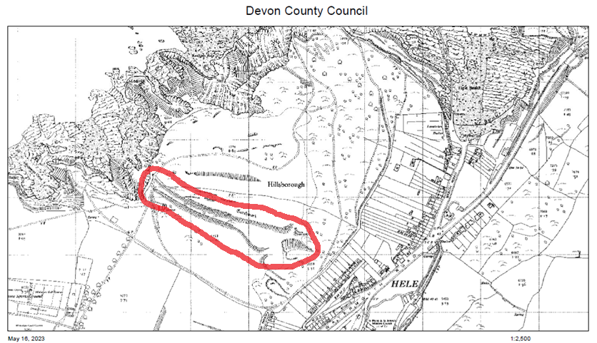
(A third, parallel feature can be seen running across the hill higher up, but this is not related to the ramparts. It is a later wall following a natural bank formed by a fold in the rocks.)
Such massive defensive banks and ditches were common all over the British Isles during the Iron Age, the term which covers the years from about 750 BC until the Roman invasion in AD43. Most of them are inland and built around hilltops. Their purposes remain a matter of debate. Most seem to have served as one or more of these:
- A defence against attack from neighbouring tribes (Some were also defended against the Romans, although many had already gone out of use by the time of the invasion)
- A meeting-place used at special times of the year
- A settlement that was occupied all year round, with evidence of many houses and storage pits inside.
- A safe place to store food or protect livestock.
- A religious centre
- The retreat of a social elite
What was the purpose of Hillsborough’s ramparts? Some clues to consider:
- The enclosed land offers poor soil, rough grazing, very little shelter, and no natural springs to supply fresh water.
- No evidence of Iron Age buildings has yet been found inside the ramparts.
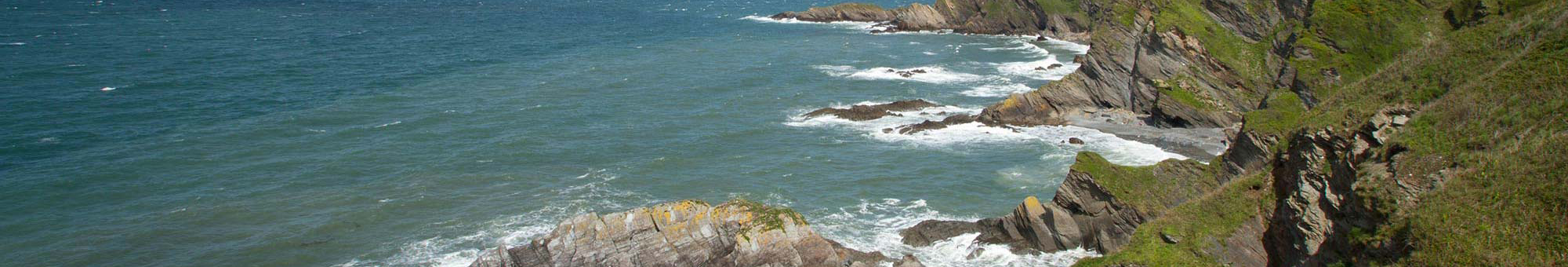
- Hillsborough overlooks, and dominates, possible landing-places at Ilfracombe harbour, Rapparee Cove and Hele Bay, and on a clear day provides a good view of the Gower Peninsula in South Wales.
- Hillsborough is said to be one of the few places in England where, at certain times of year, it is possible to see the sun both rising from and setting into the sea.
Whatever the builders’ intentions, Hillsborough’s high cliffs and impressive defences would have displayed the power of the local chief.
Two paths now lead visitors through the ramparts. The one on the west (overlooking Ilfracombe harbour) was cut through in late Victorian times, when Hillsborough became a local park. (See https://www.northdevoncoast-nl.org.uk/coastal-heritage/iron-age/hillsborough-hillfort/victorian-connections
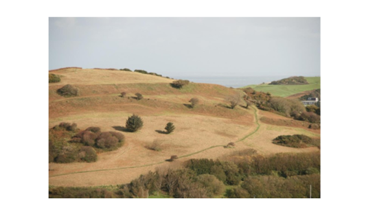
The path on the east (the Hele Bay side) is at least two thousand years older. The photo above shows it following the ancient route through the original gateways. The ramparts curve uphill at the entrance, perhaps to make it easier for warriors to fend off attackers trying to break in through the gates. (Less dramatically, it could also have made it easier to herd livestock through the gateway!)
The Roundhouse
Geophysical survey has shown traces of a typical Iron Age-style round house just outside the lower gateway. Some of the pits that held the supporting posts are still visible on the survey, including two that may have been the door-posts.
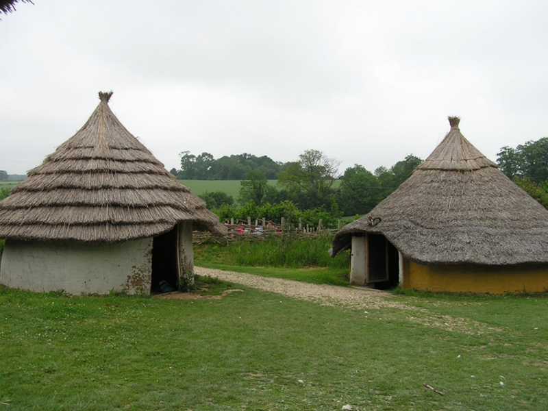
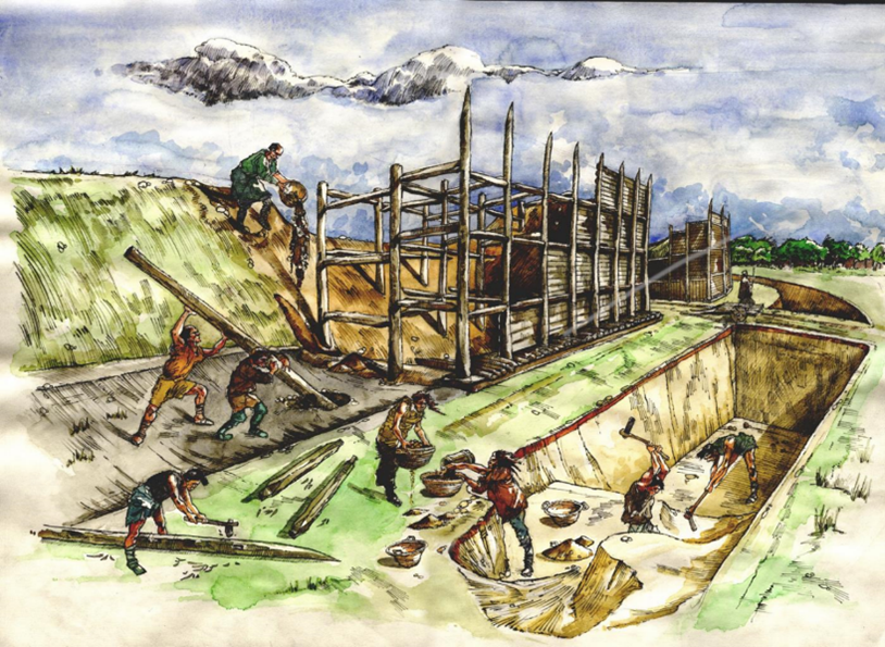
From modern reconstructions based on archaeology – such as those at Butser Ancient Farm in this photo – it is clear that with a fire in a hearth on the floor, and a thick cone of thatch above, a house like this would have provided good protection from the coastal weather. Experiments have shown that no chimney is needed: with the correct thatching, the smoke can safely be allowed to escape through the roof. The smoke helps to keep destructive insects at bay, while the thatch keeps the rain out.
The position of Hillsborough’s house raises a question, though: if the ramparts were in fact built to defend against enemies, why is the only known Iron Age building outside them?
The mystery
Some hillforts are associated with earlier monuments, and this may be true of Hillsborough, but unfortunately a major piece of evidence has gone missing.
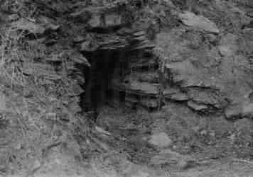
In 1937 council workmen who were digging a trench to try and halt the spread of a gorse fire came across the cavity shown in the picture. The photo was taken by Mervyn Palmer, Curator and founder of Ilfracombe Museum, and various theories about the cavity’s origins were suggested. Was it a Bronze Age burial cist? A Cornish-style Fogou (underground dry-stone structure, also from the Iron Age). Whatever it was, Mr Palmer failed to persuade the authorities to leave it open for scientific investigation. The cavity was filled in, the site became overgrown with gorse and the location is now unknown – as is the fate of the bones which were said to be found nearby.
To find out more:
For a digital map of the many known hillforts in Britain and Ireland: https://hillforts.arch.ox.ac.uk/
More about English hillforts: https://historicengland.org.uk/images-books/publications/iha-hillforts/heag206-hillforts/
More on the Iron Age in North Devon: https://johnhmoore.co.uk/hele/iron_age.htm
Butser Ancient Farm: https://www.butserancientfarm.co.uk/
More details of the finding and losing of the mysterious opening in the hillside: https://johnhmoore.co.uk/hele/hillsborough.htm