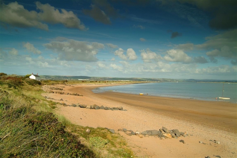
Lying at the tip of Braunton Burrows, Crow Point is a curved spit of sand which lies at the entrance to the Taw-Torridge Estuary. The open views from here are simply stunning, as is the sense of space. The area is the site of an ancient ferry crossing to Appledore and played a role in the WWII military activities that took place across the Burrows.
Landscape and Nature
Crow Point lies on the furthest edge of Braunton Burrows – all of which is part of the UNESCO Biosphere Reserve, a Site of Special Scientific Insterest and a Special Area of Conservation.
On the sheltered inner side of the spit, boats moor up in summer and you can see developing saltmarsh habitat. On the very tip of Crow Point the sand drops away steeply, formed by the estuary current. On the exposed outward facing side the sand-dunes and their marram grasses are battered by the winds, tides and stormy seas.
Bordering Braunton Burrows is the Taw-Torridge Estuaries SSSI, just falling within the AONB by virtue of the mudflats along the Skern (the eastern part of Northam Burrows) at Appledore! Although the bulk of the site lies outside the AONB, it is integral to the character of the area – Braunton and Northam Burrows would both be very different without it. The Taw-Torridge is the only north-coast estuary in Devon and Cornwall to hold significant numbers of waders. Many of the birds that winter here breed in Scandinavia or Russia, but a ‘hidden’ population of birds also use the site: these are birds which breed in the highest latitudes of all, far into Arctic Russia and Canada, and winter along the West African coast; their migration depends upon open estuaries with abundant invertebrate food.
History
Evidence suggest Crow Point is the site of an ancient ferry link between Appledore and Braunton. An ancient settlement and church associated with this important crossing are alledged to be buried in the sands nearby, but have never been found.
On Crow Point, a modern, automated lighthouse guides current day mariners to safety, but a short distance further back along the beach toward Saunton lie the remains of an old lighthouse – lived in by the lighthouse keeper and his family until its demolition.
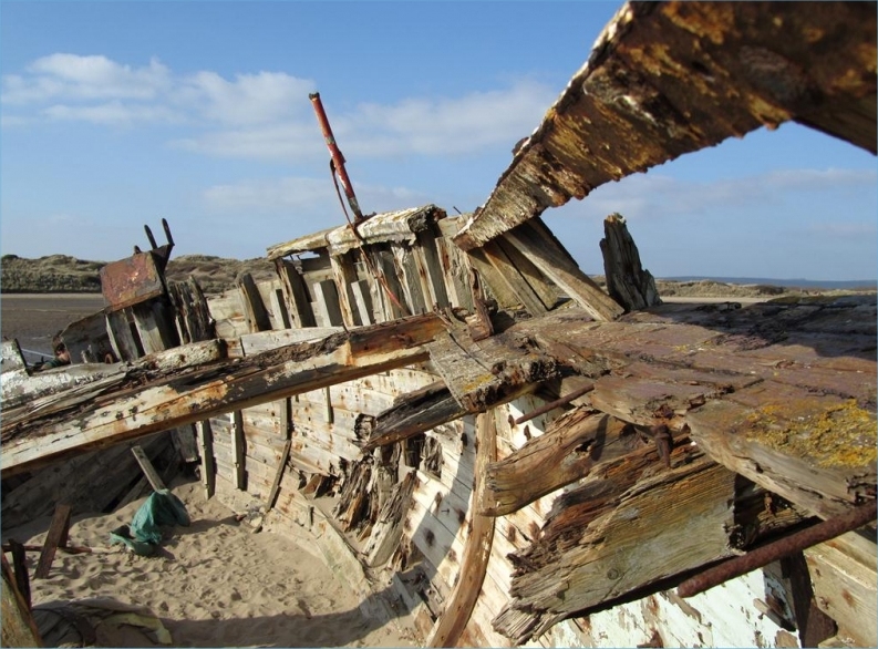
Close by, you may even see the tracks of ‘Blinking Billy’ – a moving light which moved up and down the beach on rails according to the tide.
If you’re lucky, you might even find the metal carcass of ‘Billy’, which can still be found in the dunes bordering the beach.
Activities
Crow Point is a great place for walkers and family outings, but be aware that the closest toilets and shops are back in Braunton.
Walking or cycling toward the Braunton Burrows from the Crow Point car park will lead you to the American Road. This connects up with Sandy Lane car park providing a circular route around the area.
Crow Point Trail
Surfing links
Magic Seaweed
Surf South West
Eyeball HQ
Sailing dinghies launch from a slip beside the carpark (enquire with the Toll House).