North Devon Coast National Landscape: A designated Area of Outstanding Natural Beauty
Management Plan 2026 – 2031
A PDF of the Management Plan can be downloaded here
Vision
Vision
The North Devon Coast National Landscape will remain as one of England’s finest landscapes and seascapes, protected, inspiring and valued by all where:
Outstanding landscapes and coastal communities are resilient to climate change
Wildlife and habitats are thriving, well managed, connected and expanding
Land use and management balance the need of food and timber production, nature, people and climate adaptations
More areas are accessible to all, with inclusive activities and opportunities to experience nature and the landscape
Heritage and cultural traditions maintain a distinctive sense of place and community
Introduction
The six years since the last Management Plan was produced have seen major changes in the environment, land management, climate and society that have affected the Areas of Outstanding Natural Beauty (AONB). The re-naming of AONBs to National Landscapes in 2023 was part of the refocusing of priorities to respond to the ecological and climate emergencies, and to highlight that these places are designated for the nation and therefore for everyone. However, the legal term for the designated area remains AONB.
Policy changes at international and national level are reflected in new ambitions for National Landscape Partnerships as a key delivery mechanism for nature and climate priorities, working closely with Natural England and Defra. These include the Protected Landscapes Targets and Outcomes Framework, the 30 by 30 Criteria and the Local Nature Recovery Strategies as detailed in the relevant section. New national legislation has strengthened protection of these areas by amending the duty on relevant authorities to ‘seek to further’, rather than to just ‘have regard to’ the purpose to conserve and enhance natural beauty in fulfilling their duties and making decisions affecting the National Landscape.
This fifth Management Plan is a material consideration in the determination of relevant planning applications. It includes a range of policies to which weight should be given in relevant decisions on developments and land use changes within and in the setting of the National Landscape. The Plan is for the geographic area, not just for the team and Partnership members, with eighteen policies providing a framework to guide actions that conserve and enhance its natural beauty.
The structure of this Plan reflects the fact an AONB is a geographical designation which requires protection and enhancement to meet its purpose, whilst being a priority place for nature and for people to benefit from its protection. The ‘Place’ section covers landscape, development and heritage, the ‘Nature’ section covers wildlife, land management and ecosystem services and the ‘People’ section covers recreation, access, wellbeing and community. (The Plan should be read in conjunction with the North Devon Biosphere Nature Recovery Plan whose detail informs the Nature section whilst avoiding duplication). Two cross-cutting themes of climate and equality, diversity and inclusion are reflected across all three sections due to their interaction with and relevance to so many elements of the Plan. The final sections cover the management structures, delivery of objectives and monitoring of the National Landscape. The State of the National Landscape 2025, a separate report has been strengthened by national data cut to the areas’ boundary, thereby providing additional baselines to monitor trends and achievements in delivering the Vision, aims and national targets.
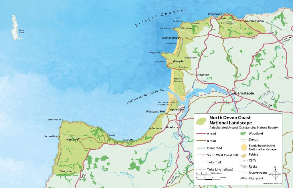
Map of the North Devon Coast National Landscape
National Landscape Partnership Chair’s Forward
This Management Plan sets out a clear and ambitious framework for the future of the North Devon Coast National Landscape (NDCNL), responding to a period of significant national change while remaining firmly grounded in the distinctive character, communities and landscapes of this remarkable coastline.
Recent legislation strengthens the role of National Landscapes, particularly through the new duty on relevant authorities to seek to further the purpose of designation. This Plan embraces those changes, recognising the importance of both the designated area and its wider setting in conserving and enhancing natural beauty even though neither statutory consultee status with Local Authorities nor of the Protected Area to include the Taw Torridge Estuary have been achieved.
The partnership agreed that climate action and equality, diversity and inclusion are embedded throughout the Plan as cross‑cutting principles, reflecting their fundamental importance to the future resilience, accessibility and relevance of the National Landscape. The increased emphasis on nature recovery, alongside Place and People, is welcomed by the Partnership and is reflected in the structure of the Plan and the aims and objectives of the delivery plan. The State of the National Landscape 2025 report pulls together relevant data and sets new baselines against which the plan’s delivery can be monitored.
I joined the AONB Partnership as independent Vice-Chair in 2018 just as the previous 2019-2024 Management Plan was being prepared. Thus, I saw the volume of work and consultation involved then. The implementation of that 2019-2024 Plan has had its ups and downs mainly due to events and decisions outside our influence, including Covid, but the Partners have continued to offer unfailing support to the staff team and a great deal has been achieved. Looking back through the minutes of Partnership meetings during my time some of our own funded highlights include the Coastal Heritage and Finding Nature’s Footprints projects, Access for All, Power Line undergrounding and the Farming in Protected Landscapes scheme, all of which have good legacies for the NDCNL. Involvement with Partners’ and public activities has also been prolific, and examples include the Biosphere’s Nature Recovery Plan and other projects, the High Tide Roost Study, Life on the Verge, West Country Buzz, ELM Pioneers, Dynamic Dunescapes, Climate Emergency work and numerous smaller projects funded through our Sustainable Development Fund amongst many others.
In 2021 I became Chair of the Partnership and have weathered the 60th anniversary of our AONB, and the subsequent somewhat contentious rebranding to a National Landscape. I have also seen staff member Dave Edgcombe depart in 2023 after 20 years with the AONB, and 40 years on the North Devon coast. His book Tides of Change shows some fascinating landscape evolution. Last year Jenny Carey-Wood departed after 10 years as manager and veteran of two Management Plans. I myself am due to stand down shortly. I have had the privilege of assisting the team to produce the new Management Plan, but we leave it in the hands of the next generation of staff and Partnership members to use it to continue to protect and enhance our splendid coastal landscape.
Dr. Eirene Williams CEnv FCIEEM(Rtd)
Ministerial Letter of Support
Protected Landscapes are our most iconic and inspiring places. They were created from 1949, with post-war Britain recognising everyone has a right to access the countryside – from Northumberland’s dark skies to the South Downs’ Seven Sisters. 75 years on, the needs are greater than ever, with nature underpinning our health, economy and climate. That’s why this government will empower Protected Landscapes to become greener, wilder and more accessible.
Covering 25% of England, but half of our priority habitats, Protected Landscapes are essential to nature’s recovery. This government understands that we will not achieve our Environment Act targets or commitment to protect 30% of nature by 2030 without Protected Landscapes.
Recovering this natural capital is essential to ensure sustainable economic growth. Protected Landscapes are fundamental to strengthening the nation’s economic health by looking after the natural resources we depend on. Through nature’s recovery, Protected Landscapes protect communities from flooding, fight climate change, enable sustainable food production and create green jobs. They also have a vital role in connecting diverse communities with nature – underpinning the nation’s mental and physical health and reducing the strain on our NHS.
This incredible potential is beginning to be set out in the Protected Landscapes Targets and Outcomes Framework. However, it will only become reality through the work of Protected Landscapes teams in collaboration with local communities, land managers, public bodies and other partners.
Protected Landscape Management Plans provide the focal point for all partners to agree a local ambition and a pathway to deliver it, shaping the future of our most special places, and therefore the country. It is vital that all partners work together to develop and implement Management Plans. To support this collaboration, we have issued guidance on the Protected Landscapes duty which requires relevant authorities to seek to further the purposes of Protected Landscapes.
In recognising their importance to the nation, this government has committed to reinvigorating Protected Landscapes with new legislation, resources and tools. I look forward to developing this with you and other partners because it is only together that we can protect and enhance these remarkable places for generations to come.
Yours sincerely,
Mary Creagh CBE MP Parliamentary Under-Secretary of State, Department for Environment, Food & Rural Affairs
Summary of Management Plan Policies
Place
A1 Having regard to the landscape and seascape character assessments, ensure that the landscape and seascape character, natural beauty and special qualities are conserved and enhanced in all decisions affecting the area
A2 Protect the dark skies, wildness and tranquillity
A3 Support the conservation and enhancement of heritage assets, historic landscapes and cultural features
A4 Support sustainable housing developments that meet local needs and can demonstrate that they conserve and enhance the National Landscape.
A5 Support renewable energy proposals that can demonstrate they conserve and enhance the special qualities of the National Landscape.
Nature
B1 Restore, create and manage habitats for wildlife richness and resilience
B2 Address and mitigate impacts of invasive species, disease and climate change
B3 Promote, encourage and support take up of agri-environment schemes and grants to conserve and enhance natural beauty
B4 Support management of landscape features including hedgerows, ponds, woodlands, dunes and streams
B5 Prioritise nature-based solutions to tackle climate change, nature loss, water management and supply.
B6 Support appropriate species management and reintroductions
People
C1 Support nature tourism activities that minimise adverse effects on nature, natural beauty and climate
C2 Improve physical accessibility and outdoor activities supported by active travel infrastructure
C3 Promote use of green and blue spaces for better connection to landscape, heritage and nature to improve human health and wellbeing
C4 Address and monitor equality, diversity and inclusion across all activities
C5 Value and involve communities and visitors with landscape, nature and cultural heritage through volunteering, events and training
C6 Support communities, visitors and businesses to change behaviour to transition to net zero
State of the National Landscape Report 2025
As part of the review process for the Management Plan, a “State of the National Landscape” report was produced in 2025. The report pulls together the data and information gathered by the National Landscape team, with its partners including Natural England. It presents data collated in the autumn of 2025 alongside comparable data from annual reviews and reports, where such exists, or to alternative baselines against which there are comparisons and trends. The full report can be downloaded here.
23%
Priority habitat
14
SSSIs
26%
SSSI features in favourable condition
33%
in agri-environment schemes
176
Farm holdings
63%
Land under agriculture
1,867.7 ha
(11%) Woodland
2,000 km
of hedgerows
3.5%
Ancient woodland
43%
Reduction in greenhouse gas 2003–2023
Average age
48
Population
12,300
18%
Residents registered as disabled
207 km
Public Rights of Way
1473 ha
of accessible green infrastructure
8/10
Bathing beaches are excellent
2m
Visitors a year
25
Scheduled monuments
6
heritage assets at risk
416
Listed Buildings
North Devon Coast
National Landscape
Statement of Significance and Natural Beauty
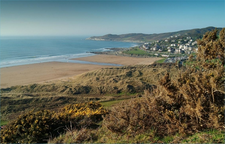
The North Devon Coast Areas of Outstanding Natural Beauty (AONB) was designated in 1959 and confirmed by the Secretary of State in 1960. It was the first of the five Devon AONBs to be designated. It covers 171 square kilometres (66 square miles) of mainly coastal landscape including special places such as Combe Martin, Lee Bay, Woolacombe, Croyde, Saunton, Braunton Burrows, Northam Burrows Country Park, Westward Ho!’s Pebble Ridge and the Hartland Peninsula. The extensive, mobile, dune system at Braunton Burrows has an immense diversity of wildlife and lies at the heart of the AONB. In 2002 Braunton Burrows earned the international status of a UNESCO World Biosphere with the AONB being an important aspect of its core and buffer zone. The statement of significance defines what makes the North Devon coast special, describes the natural beauty of the areas and identifies the qualities that justify its designation as a nationally important landscape.
Statement of Significance
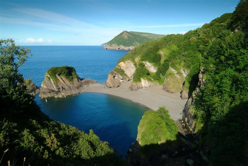
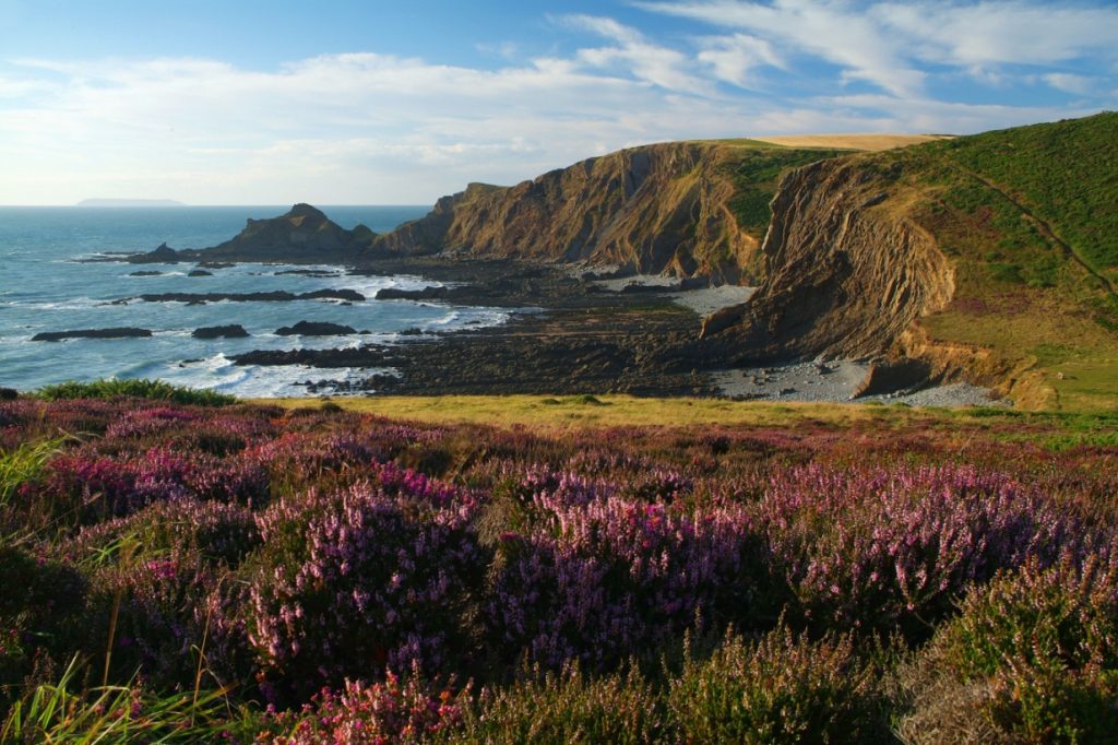
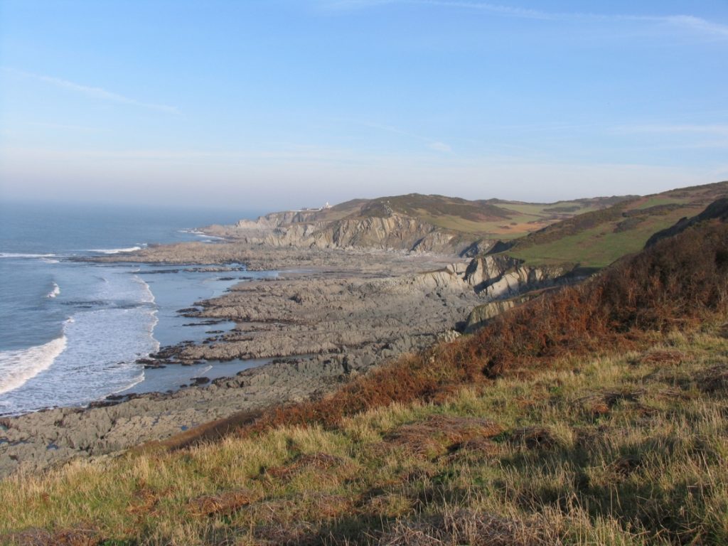
The North Devon coast has a wide diversity of scenery including some of the of the finest cliff scenery in the country, the primary reason for its designation. Tall, rugged cliffs and wave-cut platforms contrast with wide, sandy bays and sand dunes. In the north, steeply dipping rocks form hogsback cliffs at varied heights in a natural continuation of Exmoor’s coastline. To the south, facing the full force of the Atlantic, sheer crags and razor-like reefs present the coast at its most rugged and beautiful. The AONB reaches inland to the Hartland plateau, scored by deep valleys, which reach the coast as steep hanging gaps in the cliffs, often with spectacular waterfalls.
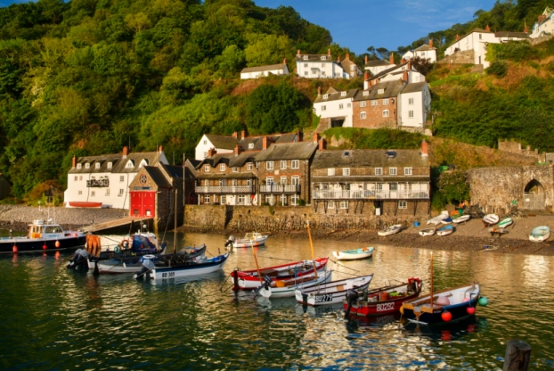
In contrast, the broad sweep of Bideford and Barnstaple Bay is a mixture of low cliffs, long sandy beaches and the dunes at Braunton Burrows. Inland a pastoral landscape of hedged fields complements the steep-sided wooded combes and valleys where villages shelter from the Atlantic winds. Whilst skirting larger settlements such as Ilfracombe and Westward Ho!, the AONB boundary takes in bustling seaside resorts such as Woolacombe and Croyde and picturesque fishing villages such as Clovelly and Bucks Mills along this spectacular coast.
Distinctive Coastal Scenery
Walking along the South West Coast Path across the open, windswept clifftops, and gazing westward across the seemingly infinite expanse of ocean, there is a sense of timelessness and of raw nature devoid of human influence. The feeling is sharpened when Atlantic storm waves crash against the twisted strata of exposed rocky cliffs, sending thunderous sprays of surf into the air. Dropping down into a coastal combe from the cliffs or farmland, a strong sense of refuge and shelter prevails, made more striking by the presence of enclosing woodland in the combes.
Where stretches of coastline are distant from the coast road, a sense of tranquillity and remoteness is strong. In Braunton Burrows, the vast sand-dune system, infinite sky and an expansive sandy beach are bordered by tranquil grazing marshes. Likewise, the Hartland Coast possesses a sense of wilderness, but this is a fragile quality, which can dissolve with the sight of a wind turbine or mast on a skyline, or a car parked in an open combe. Coastal landforms provide classic examples of erosion and deposition, as well as rare and characteristic landscape features and habitats.
A Landscape and Seascape of High Visual Quality
Panoramic views from elevated areas across rolling countryside are an important feature of the AONB. Within the combes, framed sea views are characteristic, and coastal vistas across to Lundy are wide and empty. Further north the view is framed by intimate distant views of the Welsh coast. Inland, the countryside, much of it undesignated, forms an important backdrop to the coast and is a defining element to the visual quality of the AONB providing a variety of open views. The coast path provides long views along the coast across the estuary and inland to the undeveloped skyline and downland.
A Significant Wildlife Resource
Much of the coastline is designated for its biological importance. The rarest AONB habitat is rush pasture, or Culm Grassland, small fragments of which are found on the wet inland moors of the Hartland area such as Bursdon and Brownsham Moors. Elsewhere, there are mosaics of maritime grassland, heathland and scrub, estuarine salt marsh, along with sea cliffs and rocky shores especially around Morte Point and Hartland Quay. There are internationally important sand dunes at Braunton Burrows, the core of the UNESCO Biosphere reserve and hundreds of miles of hedgerows with isolated trees and Devon hedge-banks providing extensive havens throughout the inland area. Western oak woodland (now recognised as temperate rainforest) is found along the Clovelly coast and within the combes, whilst excellent air quality, constantly freshened by Atlantic westerlies, is a particular asset supporting a proliferation and richness of lichens, all contributing to the local landscape character.
A Varied Geology
Much of the coastline is also designated SSSI for its geological importance. Coastal landforms provide classic examples of coastal erosion and deposition as well as rare and unique landscape features. These include the pebble ridge at Northam Burrows, the mobile sand dune system at Braunton Burrows, Blackchurch Rock at Brownsham, the Tuts Hole anticline at Abbotsham and the dramatic waterfalls cascading on to rocky shores from truncated combes. The variety of coastal landforms from wave-cut platforms to wide sandy beaches offers an immense resource for marine wildlife that inhabit the foreshore. The geological features also offer a range of opportunities for people to enjoy and benefit from the designated area including walking the coast path and inland footpaths, wildlife watching, beach activities, horse-riding, cycling, climbing and coasteering. The main water sport is surfing from the vast sandy beaches with international recognition through designation in 2023 of the 12th World Surfing Reserve,and the first in the UK.
A Remarkable Heritage
The legacy of a long history of human habitation in the area is woven into the landscape, with some threads tracing back to pre-historic times. The most extensive historic landscape features are the enclosed fields defined by ancient hedge-banks, from the narrow, enclosed strip fields of Combe Martin to the 19th century regular enclosures of the downland above Ilfracombe, their patterns reflecting centuries of agricultural change. This is made more appealing by historic farmsteads, hamlets and villages and the winding lanes which connect them.
Inland the ridgelines are marked by ancient burial mounds and the large Clovelly Dykes hillfort. Along the coast, promontory sites such as the ancient earthworks at Hillsborough and Embury Beacon, have been home to strategic defences from the Iron Age to the 20th Century wars, the latter reflected in the remains of Second World War structures from the activities of the American troops based along the coast in preparation for D-Day and the ongoing military activity from the nearby Royal Marines Bases at Chivenor and Instow. Devon’s seagoing heritage is represented by historic quays and fishing villages like Clovelly, with lime kilns in almost every inlet and wrecks of ships and planes on both land and sea.
Special Qualities and their Characteristics
Diversity of scenery contained within a small area, including some of the finest cliff scenery in the country.Panoramic seascape with seaward views to Lundy within the Atlantic Ocean, across the Bristol Channel to Wales and along the coastline.Narrow framed views of the sea from coastal mouths of steep sided combes.Panoramic views across a rolling landscape of pastoral farmland and wooded combes and valleys, towards the sea from elevated inland areas.Wild coastal scenery with hogsback cliffs of varying heights and high, rugged cliffs, dramatic rock formations, exposed headlands, wave cut platforms and rocky coves. The diverse wildlife-rich habitats form a “coastal wildbelt” running the length of the North Devon coast.A vast sand dune system at Braunton Burrows of exposed wild character, with high nature-conservation interest of international importance.Long, broad sandy beaches backed by extensive dune systems. The international significance of these beaches is recognised in designation as the UKs first World Surfing Reserve.A strong sense of tranquillity and remoteness where the coast road is located away from the coastline.Rare and fragile quality of wilderness in Braunton Burrows and on the Hartland coast.Historic landscape pattern of hedge-banks, farmsteads, hamlets, villages and lanes.Historic coastal quays and fishing villages, coastal promontory sites for strategic defences and lighthouses.Deep combes and cliffs cloaked in ancient woodland along the Bideford Bay coast.Small pockets of remnant lowland coastal heathlands around Morte Point and Hartland Quay.Tourist-orientated settlements in sheltered seaside locations.Secluded, secretive and tranquil steep sided valleys that dissect the downland and coastal plateau.Dark night skies, particularly in the Hartland Peninsula
Purpose of the Designation and the Management Plan
The natural beauty is as described in the statement of significance. Subsequent legislation has emphasised that in pursuing the primary purpose, account should be taken of the needs of agriculture, forestry and rural industries as well as the economic and social needs of local communities. Regard should be paid to social and economic development that conserves and enhances the natural and historic environment. Whilst recreation is not an objective of the designation, the demand for recreation should be met insofar as it is consistent with the conservation of natural beauty.
To Conserve and Enhance Natural Beauty
Duty on Relevant Authorities
The protection of AONBs was strengthened in 2023 by amending the duty on local authorities regarding the purpose and extending it to all relevant authorities. Clause 245 Protected Landscapes of the Levelling Up and Regeneration Act 2023 places a duty on relevant authorities in respect of their actions, decisions and operations whereby they ‘must seek to further’ the statutory purpose of the National Landscape. Guidance and case law are interpreting this new duty, that has replaced the ‘duty of regard’.
Purpose of the Management Plan
Describe the natural beauty to be conserved and enhanced, and special qualities
Summarise the trends in the condition of the natural beauty and socio-economic character of the area
Describe the drivers for change and issues acting on the designation
Present the ambition and strategy including the contributions of delivery partners.
Identify management approach and policies to guide activity and decisions
Establish measures of progress and success, including specific targets and timelines
Audience for the Management Plan
A plan for the geographic area prepared by the National Landscape Partnership and team
Local planning authorities who have the statutory duty to prepare and review the AONB Management Plan
Relevant authorities such as government, government agencies, local authorities, parish councils, utility companies
Landowners, land managers and developers
Local communities, businesses, voluntary sector organisations and visitors
National and Local Policy Context
Countryside and Rights of Way (CRoW) Act 2000 provides clarification on the management and significance of AONBs that were legally designated through the National Parks and Access to the Countryside Act 1949. Section 89 placed a duty on local authorities in the designated area to prepare and review a Management Plan, and Section 85 placed a duty on relevant authorities to conserve and enhance natural
Levelling Up and Regeneration Act (LURA) 2023 has strengthened Section 85 of the CRoW Act through Section 245 Protected Landscapes so that “In exercising or performing any functions in relation to, or so as to affect, land in any [Protected Landscape] in England, a relevant authority must seek to further the specified purposes”. This applies to the setting of a protected landscape too.
The Land Use Framework for England, published in March 2026, sets out England’s first strategic approach to using land more effectively to meet long‑term priorities for food production, development, nature recovery and climate resilience. The Framework recognises National Landscapes as important delivery areas for nature recovery, including the 30by30 commitment, and highlights the role of National Landscapes and their Management Plans in convening partnerships and coordinating cross‑sector action to deliver both local and national priorities
National Planning Policy Framework (NPPF 2012 revised 2024)National Planning Policy Framework (NPPF 2012 revised 2024)vii sets out planning policy for National Landscapes, specifically Paragraph 189 gives great weight to conserving and enhancing landscape and scenic beauty and Paragraph 190 that permission should be refused for major development other than in exceptional circumstances.
The Government published a revised draft National Planning Policy Framework (NPPF) in December 2025 which was at consultation stage at the time of drafting this management plan. The policies are not yet in force, and the introduction of the changes is subject to a consultation that ends on 10 March 2026. The new NPPF is very different from its predecessors and is expressed as a number of policies for plan-making and decision-making. From the time that it is published any policies of adopted Local Plans or Neighbourhood Plans that are “in any way inconsistent with the national decision-making policies” outlined in the NPPF should be given “very limited weight” in decision-making. The draft Framework sets out revised guidance and decision-making policies for planning across England. It continues to assign the same high value and degree of protection to National Landscapes and stipulates that substantial weight should be placed on the importance of conserving and enhancing their natural beauty. It also confirms that the scale and extent of development in National Landscapes should be limited and sensitively located to avoid harm to their statutory purposes and special qualities. It continues to stipulate that major development will only be permitted in exceptional circumstances subject to a number of stringent tests, while development within the setting of National Landscapes should be sensitively located and designed to avoid or minimise adverse impacts on the designated areas. The NPPF draft starts to articulate the role of the planning system in helping to deliver aspects of the Nature Recovery Strategies and addressing climate change. The new plan making policies of the NPPF highlight the importance of using relevant environmental evidence, including Local Nature Recovery Strategies, to set out areas which need safeguarding from development because of their importance for nature; balancing the need to safeguard areas because of their potential for nature with the need to deliver development, pursue opportunities for nature recovery, and direct development away from sensitive locations. New provisions include requirements for plan-makers to set clear standards for green infrastructure, drawing upon national benchmarks.
The Colchester Declaration 2019 was made by the National Association of AONBs to pledge action for nature including a Nature Recovery Plan for each AONB, to create opportunities for people to make an emotional connection with nature, to embed an ecosystems services approach into Management Plans and to include meaningful measures to achieve Net Zero.
Environmental Improvement Plan 2023 (EIP) sets the UK goals for enhancing the natural environment, including the ’30 by 30’ commitment, and the targets to restore or create more than 500,000 hectares of wildlife-rich habitats outside protected sites by 2042 and to halt the decline in species abundance by the end of 2030, increasing it to above 2022 levels by 2042.
Protected Landscapes Targets and Outcomes Framework (PLTOF) sets the ambition for how Protected Landscapes are expected to achieve three outcomes from the EIP 2023 related to place, nature and people. The ten targets are non-statutory, are for the geographic ‘place’ and it is the responsibility of the Partnership, stakeholders and land managers to assist in their delivery. Baseline national data cut to the National Landscape boundary were produced in 2024 by Defra, Natural England, Forestry Commission and Historic England and will be used to monitor progress against the targets, which are included in the Management Plan indicators monitoring.
‘30 by 30’ Commitment is the target to protect 30% of the UK’s land and sea for nature by 2030 in commitments made at the COP15 Biodiversity Summit. The national approach is a focus on SSSI’s in Protected Landscapes, working to get more into favourable condition and identifying other nature rich areas that meet the criteria. The National Landscape Partnership has an important role in helping to deliver on ’30 by 30′, through the ambitions of the Management Plan with the potential to convene, catalyse and support nature recovery actions with partners and landowners that are rigorous, consistent and meeting the stated 30 by 30 criteria.
Devon Local Nature Recovery Strategy The Devon Local Nature Recovery Strategy (LNRS)has been developed by Devon County Council under the Environment Act 2021 to provide a strategic, county‑wide framework for nature recovery.
The LNRS maps priority habitats and species, identify key areas for protection and recovery, and highlights opportunities to restore and connect habitats. Within the North Devon Coast National Landscape, the LNRS will help prioritise landscape‑scale habitat creation and connectivity, supporting delivery of the Environmental Improvement Plan, the ‘30 by 30’ commitment and the Protected Landscapes Targets and Outcomes Framework.
Integrating the Management of the Natural and Historic Environment, a joint statement between Natural England, Historic England and the National Lottery Heritage Fund in which each organisation commits to act as strong advocates for the added value that integrated management approaches deliver, producing positive changes that leave a legacy to future generations of high-quality placemaking, maximising the value of environmental opportunities and minimising the inadvertent harm caused by short-term decision-making.
North Devon and Torridge Local Plan 2011-2031 was adopted in 2018 and sets out the vision, strategies and policies to shape the development of northern Devon. Policy ST14 Enhancing Environmental Assets includes ‘conserving the setting and special character and qualities of the North Devon Coast Areas of Outstanding Natural Beauty whilst fostering the social and economic wellbeing of the area’.
Neighbourhood Planning, Proposals for development within these areas should be considered against the policies in the relevant neighbourhood plan, alongside policies in the Local Plan. Currently there are two formally adopted neighbourhood plans in the AONB, Georgeham Parish Neighbourhood Plan (2022) and Braunton Parish Neighbourhood Plan (2023) with others in development.
North Devon and Somerset Shoreline Management Plan 2010 sets out strategies for managing the coastline over a 100-year period taking account of coastal processes through a non-statutory framework to reduce risks to people and the developed, historic and natural environment. This has a major influence on the coastal and estuarine setting of the National Landscape and associated issues of habitat loss and creation, development management, water quality and recreation.
North Devon UNESCO Biosphere Reserve was designated in 2002 with three distinct zones to provide a ‘living laboratory’ for demonstrating innovative approaches for sustainable development in areas of high environmental quality. Braunton Burrows is the core of the Reserve which operates at an ecosystem scale, defined by the catchments of the Rivers Taw and Torridge and offshore marine areas stretching out to Lundy. The Biosphere’s ten-year strategy is under review in 2025 and includes the whole of the National Landscape.
North Devon Biosphere Nature Recovery Plan 2021-2030 addresses the root causes of nature’s decline by prioritising making more and better space for nature over 30% of the Biosphere in the areas where it will make most difference, and building nature’s recovery into productive farming and forestry across the entire landscape as well as in towns and villages. Five action plans cover Coast; Grassland and Arable; Towns and Villages; Trees, Woodlands and Hedges, and Wetlands and Waterbodies. Ongoing monitoring of progress will be reported in 2025 and the plan refreshed for the next five years. All five action plans include priorities for the National Landscape.
Public Survey Results
As part of the review of the Management Plan, an online public survey was promoted in late 2024 to gauge public views on the National Landscape in terms of awareness, values and priorities. There were 466 responses of whom 92% know it is a designated area, 62% live in or in the setting of the National Landscape and 90% were aged over 35. 55% live or work in the National Landscape and a further third visit weekly or monthly. Their top activities or reasons for visiting are walking, relaxation/peace/quiet and surfing/swimming/water sports, followed by wildlife watching and dog walking. Two-thirds travel by vehicle to the area with half then walking, cycling or using buses to move around. Having asked what respondents valued most about the National Landscape, they were then asked to prioritise actions to conserve and enhance the area into the future and these are the top responses:
Value most about the National Landscape
Coast path, footpaths and open access areas
Wildlife and birds
Wild coastal scenery – cliffs and rocky shores
Sandy beaches and sand dunes
Priority Actions for People
Connect people with nature and the outdoors for their wellbeing
Help people to manage behaviours in relation to dogs, litter, countryside code
Improve public and community transport for residents and visitors
Priority actions for Nature and Climate
Use nature-based approaches to reduce climate change impacts
Support nature recovery by habitat creation and better connectivity
Work with businesses and communities to change behaviours
Priority Actions for Place
Protect water quality in streams and on bathing / surfing beaches
Support farming and land management that benefits nature, climate, people and place
Ensure new land uses and developments conserve and enhance natural beauty
Cross-Cutting Themes
Two themes have a significant impact across the whole plan and are considered intrinsic to all operations and therefore cross-cutting and integrated into all sections. Firstly, the climate emergency has become even more pronounced since the review of the last Management Plan, with impacts on most elements of this Plan and is being addressed through a range of specific work at the local, regional, national and international level. Secondly, National Landscapes are for everyone and for this to be achieved it requires integrating equality, diversity and inclusion throughout the management, development, implementation and monitoring of the Plan to reach and benefit a wider diversity of communities. These two themes are integrated into the Place, Nature and People chapters guided by the following principles and targets: –
Climate
Many Partnership members are signed up to the Devon Carbon Plan and actively working under the Devon, Cornwall and Isles of Scilly Climate Adaptation Strategy to achieve Net Zero greenhouse gas emissions by 2050. Guidance from Natural England highlights the role of National Landscape Management Plans in contributing to targets through the Protected Landscapes Targets and Outcomes Framework (PLTOF):
Target 6 – Reduce net greenhouse gas emissions to net zero by 2050, relative to 1990 levels.
This contributes to one of the government’s legally binding targets and in consequence there is good monitoring by relevant authorities. Commercial scale energy generation is vital to meet these targets which could conflict with the special qualities and landscape character if developed within or in the setting of the National Landscape. There are proposals for floating offshore wind farms in the Celtic Sea and national energy infrastructure projects with power cables making landfall in the National Landscape to provide grid connections. Mitigation of impacts on the protected landscape are proposed. This target is in the People section.
Target 8 – Increase tree canopy and woodland cover (combined) by 3% of total land area by 2050 (from 2022 baseline).
The North Devon Coast National Landscape contribution is proposed as an additional 3% local coverage towards the national target based on a methodology taking into account existing habitats, tree planting and woodland strategies (refs), landscape character, heritage value and suitable habitat opportunities. This target is in the Nature section.
In addition, all National Landscapes will produce a Climate Change Adaptation Plan by 2028, to complement the Management Plan. This will be produced with partners based on the Devon Climate Adaptation Plan and evidence from national datasets, customised to the profile of the area.
Climate Principles
Developing renewable energy appropriate to the landscape, such as solar panels on roofs rather than fields, and installations at a small scale, domestic or through shared community projects.
Developing nature-based solutions to rebuild the natural functioning of ecosystems, such as increasing tree cover to store carbon dioxide or slowing the flow of water to reduce flooding.
Promoting active travel options that reduce private car use such as public and community transport, and developing walking, cycling and accessibility infrastructure.
Equality, Diversity and Inclusion (EDI)
Partners and stakeholders working to deliver the Management Plan priorities, must actively address how they work, who they work with and who benefits to increase equality, diversity and inclusion. National Landscapes are designated for everyone and in addition to being welcoming, an active approach is needed to address barriers, preconceptions and exclusions that affect both physical and psychological engagement. Physical access to the health and wellbeing opportunities of the National Landscape are addressed in a national target, but other local indicators are included to support a wider range of monitoring: –
Target 9 – Improve and promote accessibility to and engagement with Protected Landscapes for all
using metrics based on those in the Defra Access for All programme. This target and other local EDI indicators are included in the People section.
EDI Principles
Taking positive action to increase diversity in representation on the Partnership, in core and project teams.
Monitoring attendance, activities and engagement methods to ensure reach and opportunity for diverse communities
Engaging new audiences through new networks, contact methodologies, creative opportunities and working in partnership
Providing volunteering opportunities to increase knowledge, understanding, skills and promote connection to nature, landscape and heritage
Providing skills training within all projects and programmes of work to ensure a legacy of skills and knowledge to conserve and enhance the National Landscape
Place
Landscape and Seascape
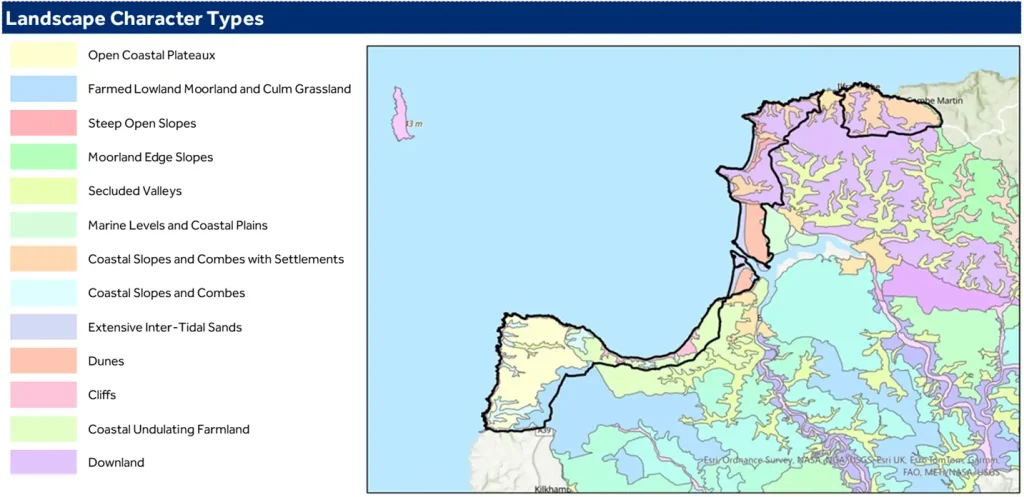
The North Devon coast’s designated Areas of Outstanding Natural Beauty cover a long and narrow sliver of largely coastal land based on the catchments of the coastal streams of Hartland and North Devon. This reflects the reasons for designation – coastal cliffs, coastal scenery and sand dune systems. To assist in the management of the areas several Landscape Character Assessments have been undertaken which can be viewed as maps on the DCC Environment Viewer. These Assessments provide an objective appraisal of what special features and qualities make the landscape valuable and worthy of conservation. They look at the local character, sense of place and drivers for landscape change to inform decisions on development, land management and nature recovery, with guidelines to protect, manage and plan for the area.
Alongside the Devon Landscape Character Areas produced in 2011, there are the Landscape Character Types from the 2023 North Devon and Torridge Landscape Character Assessment Update and the Seascape Character Assessment for the Exmoor and North Devon Coast produced in 2015 in response to proposed offshore renewable energy production and to help protect the coastline for future generations. The Historic Landscape Characterisation (HLC) identifies and interprets the varying historic character within an area looking beyond individual heritage assets. The North Devon Coast, as it appears today, is strongly influenced by the HLC.
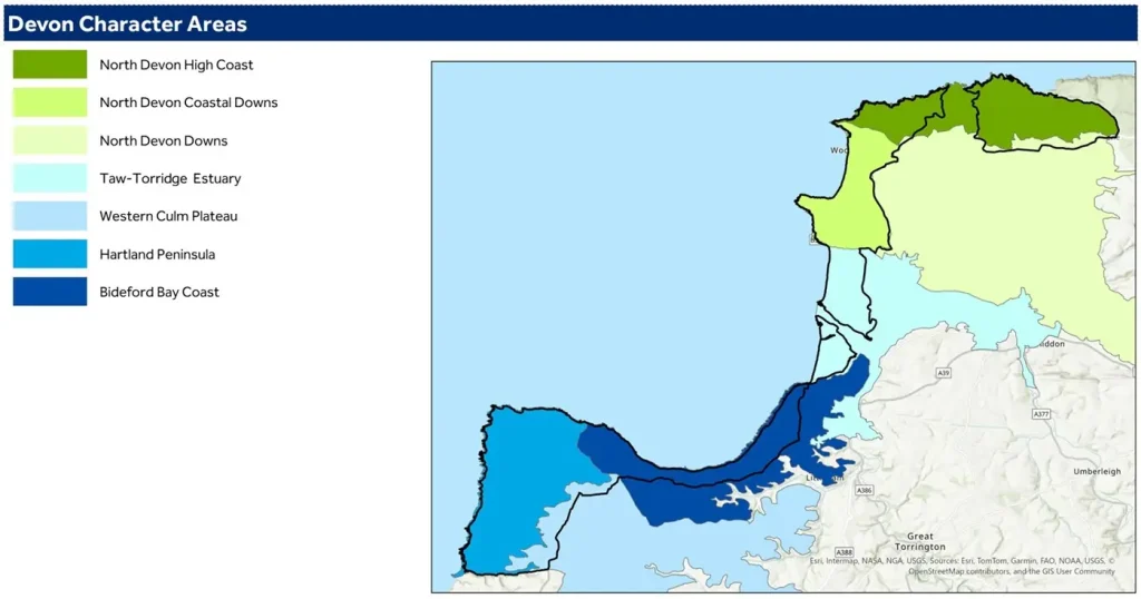
Devon Character Areas and the Setting
The Devon Character Areas are geographically unique and recognisable at a county level. They provide a valuable evidence base for the National Landscape Partnership, local planning decisions and development of local plans, by articulating what is distinctive and special.
North Devon High Coast
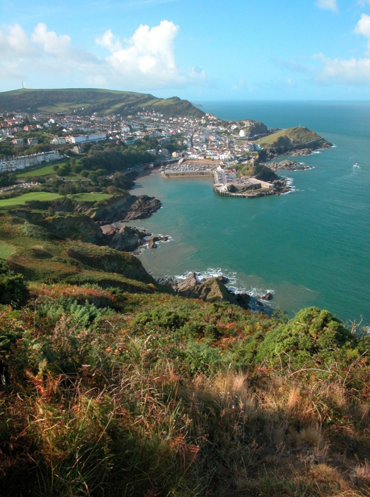
This is an area in the far north of the AONB stretching from Combe Martin to Morte Point and covers the important seaside resort of Ilfracombe. It is a landscape of spectacular seascapes, with a rugged, jagged coastline containing a series of rocky headlands and small coves with grey shingle beaches. The western part of the area has a remote and ancient feel, with extensive areas of colourful coastal heath and grassland containing prehistoric standing stones. The area around Ilfracombe is more developed, its imposing Victorian architecture telling the story of its rise as a holiday destination. The enclosed, wooded coastal combes (each with its own unique character) cut through rolling, agricultural downland to the sea. Trees are prominent features which soften the windswept landscape of the open downland below the ridge tops.
North Devon Coastal Downs
From the headland at Morte Point to the ridgeline at Saunton Down, and covering the resorts of Woolacombe and Croyde, this is a landscape of contrasts, dominated by its seascape. There are wide westerly views to the sea, with the long, low outline of Lundy visible on the horizon, and views across Bideford Bay as far as Hartland Point. A series of rolling downland ridges run on to long headlands interspersed with wide sandy beaches. The smooth downland has an elevated, open, character, whilst the rough headlands feel wild, remote and windswept. The beaches are crowded with holidaymakers in summer, but in winter they feel empty and desolate. This is a colourful landscape – green fields; golden sands; vivid purple and yellow heath; brown and grey rocks; and glorious sunsets – but its mood is always set by the ever-changing sea.
North Devon Downs
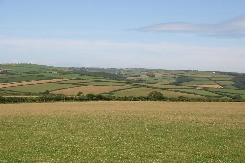
Inland, the North Devon Downs is a simple, agricultural landscape dominated by the sky within an open, westerly aspect. The smooth hills have rounded profiles, and are covered by a patchwork of large, regular fields. Views are long and wide, sometimes with glimpses of the sea or estuary as a backdrop. The steep valleys which punctuate the downland run like wooded ribbons across the landscape, contrasting with the farmland in their rich colours and textures. These valleys have a secluded and secretive character. They are very tranquil, the only sounds often being birds and running water; and their sunken lanes have a timeless quality. Small sections of this Landscape Character type occur within the AONB occupying the high ground behind the coast and, whilst largely undesignated, it forms an important visual backdrop to the AONB, helping to define its setting.
Taw and Torridge Estuary
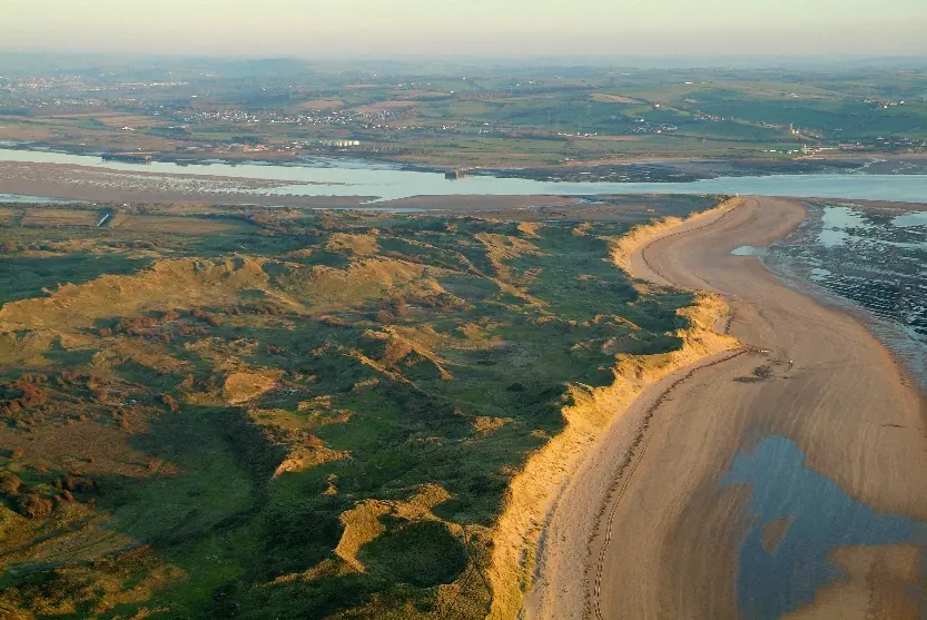
This Landscape Character Area sits astride the Taw-Torridge Estuary and covers the internationally important sand dune system at Braunton Burrows, which is the core of the UNESCO Biosphere Reserve. It is a flat, sky-dominated landscape with strong sensory characteristics. The habitats within the mosaic (dunes, beach, saltmarsh, mudflats and farmland) each have unique qualities of pattern, colour and texture which are juxtaposed in different combinations. The salty smell of mudflats and the sea are ever-present, as are the calls of birds. Within the dunes, the landscape feels disorientating, and has a strong sense of enclosure, isolation and wilderness. This contrasts with the open views towards the surrounding settlements, and the history associated with the strip fields at Braunton. The estuary settlements have a strong maritime character, with historic quays and impressive bridges.
Bideford Bay Coast
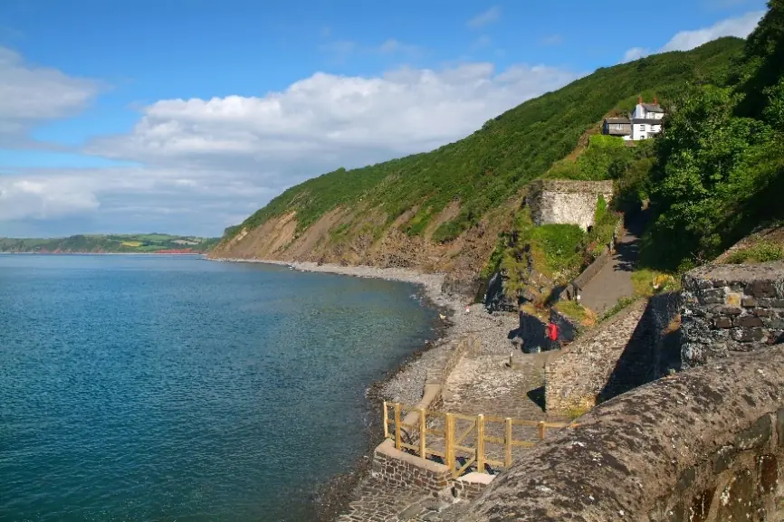
Running from the seaside resort at Westward Ho! to the west of Clovelly, the Bideford Bay Coast begins with rolling farmland that runs right up to the coastline. It is largely defined by its deep combes cloaked in oak woodland winding inland from the wooded cliffs, with carpets of bluebells in spring. Streams rush down the valleys, and ferns thrive in the dark, damp conditions. The woodland paths, with their glimpsed views of the sea, have a sense of intimacy, secrecy and peace. Narrow lanes with high, fern covered banks provide access to the sheltered combe villages of Bucks Mills and Clovelly, the latter with its picturesque harbour and whitewashed houses. On higher land behind and between the combes is a lush landscape with a rolling patchwork of fields, a peaceful settled feel, and views of the woodlands and the sea. There are open sea views across Bideford Bay towards the Taw Torridge estuary, with Lundy a distinctive feature on the horizon
Hartland Peninsula
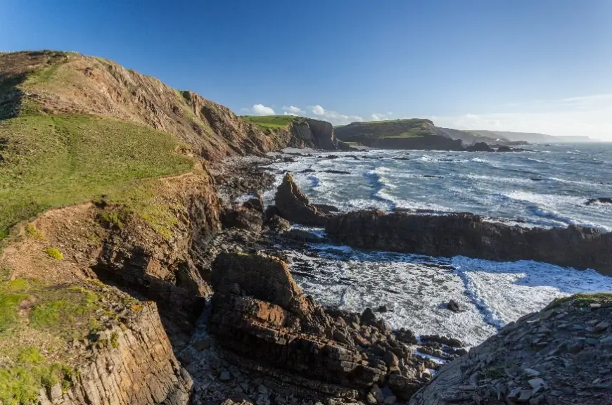
The Hartland Peninsula forms the most southern part of the AONB and includes the settlement of Hartland. In the Hartland Peninsula, complex geology, combined with centuries of pounding by the full force of the Atlantic waves, has produced some of the most dramatic seascapes and coastal scenery in Devon. The cliffs are high and rugged, with zig-zag faults and folds. Wave-cut platforms and spectacular coastal waterfalls are also distinctive features of this jagged, exposed and windswept coastline, with the profile of Lundy visible in the open seascape. Coastal heathland on the cliff tops produces vivid and changing colours for much of the year. Inland, the area contains an open, flat, elevated plateau of agricultural land, which contrasts with the twisting, wooded and secretive combes that are cut into the plateau at its coastal edge. Dramatic sunsets over the sea add to the drama of the area.
Western Culm Plateau
Inland sections to the south and east of Hartland are categorised by the Western Culm Plateau. The important culm grassland at Bursdon Moor lies within this landscape character area, although much of this LCA lies outside of the boundary of the AONB, it nonetheless helps to define the inland setting of the AONB. This open landscape of pastoral farmland, rough ground and forests has an elemental, empty character, dominated by wet, unenclosed moorland, including Dartmoor and Bodmin Moor in the distance. The colours of the moorland – yellow gorse, purple heather and golden grasses – contrast with the dark green of coniferous plantations and the patchwork of brighter green pastoral fields. Occasional clustered villages are linked by straight lanes flanked by rush-filled ditches.
Lundy Island in the Setting
Whilst Lundy Island lies outside of the protected area, it is defined as Heritage Coast and provides the marine setting to the AONB. This is a significant element of the seascape character assessments of the AONB. Lundy is an isolated and unique place, surrounded and dominated by the ever-changing sea. Remote and undeveloped, it is a ‘sanctuary’ away from the mainland. Its seascapes are dramatic, with sheer cliffs rising out of the water, battered into dramatic shapes by the force of the Atlantic breakers. The desolate, windswept moorland is alive with the sounds of crashing waves and the cries of sea birds. The island’s remoteness from 21st century life, and its sense of changelessness, is enhanced by the extraordinary richness of its history, stretching as far back as prehistoric times
Landscape Character Types
The more detailed Landscape Character Types described in the North Devon and Torridge Joint Landscape Character Assessment 2023 are used as the basis for advice on and decisions regarding proposed developments and land use change in the National Landscape. They include guidance to protect, manage and adapt the landscape and its uses to respond to biodiversity, climate and development pressures.
Geology
The ‘geodiversity’ of the North Devon Coast encompasses a variety of rocks, minerals, fossils, landforms, sediments and soils, working together with natural processes, such as erosion and landslips that may still be active. The rocks, fossils and minerals have been formed over millions of years, shaping the landforms of the area and providing much of the spectacular scenery along the coastline.
The underlying geology is a mixture of carboniferous sandstones and shales, Devonian slates, sandstones and volcanics, with areas of transition sandwiched in between. Spectacular zig-zag patterns in the carboniferous rocks can be seen along the Atlantic coast at Hartland Quay. This illustrates how the rocks were crumpled and contorted by the collision of crustal plates and thrust up into mountains. In the northern part of the AONB, the slates and sandstones provide building materials, clearly visible in the village of Mortehoe. A scattering of Limestone intrusions around Ilfracombe and Combe Martin have left their legacy in the remains of industrial heritage such as lime kilns and burners.
Within the North Devon Coast AONB there are 10 designated geological SSSI, with 102 features of which 51% are in a favourable or favourable recovering condition as of 2024. Additionally, there are thirteen Regionally Important Geological Sites (RIGS) defined due to their value for education, geological research or aesthetic reasons. Whilst they are non-statutory designations, they can be recognised as important “material considerations” when local authorities assess relevant planning applications.
The Setting
Developments and management activities outside of the designated area but in the setting, be it on land or at sea, can have a profound effect across the entire National Landscape due to its narrowness and topography. This is recognised in Section 85 of the CRoW Act 2000 and the amended duty ‘to further the purpose’ in LURA 2023 which state that the duty applies to ‘functions undertaken outside the of the designation boundary which affects land within the protected landscape’. Particular mention is made of the importance of functional connectivity with the setting in terms of water resource management, ecological connectivity, access and recreation.
The main features in the setting include: the Taw Torridge Estuary and the wider catchments of these two rivers which specifically affect water quality, biodiversity, tranquillity and visual impact; the headwaters of the river Torridge starting in the Hartland peninsula; the marine environment including the Atlantic Ocean, the Bristol Channel and Lundy Island which impact on the seascape, visual impact, recreational impact and biodiversity; and the settlements of Ilfracombe, Northam and Westward Ho! with effects on tranquillity, visual impact and recreation. Much of the setting has its own protections and designations including the AONB, Lundy Island and Braunton Great Field and Marshes defined as Heritage Coast in 1990 for Hartland and in 1992 for North Devon and up to two nautical miles from the mean low water mark. The Taw Torridge Estuary is a designated SSSI and there are two Marine Conservation Zones covering most of the coastline – Hartland Point to Tintagel and Bideford to Foreland Point. The biodiversity value of the setting reflected in these protections, both marine and terrestrial, underlines the importance of ecological connectivity to avoid barriers to the movement of species and opportunities for nature recovery.
Planning
The National Planning Policy Framework (NPPF) provides specific planning guidance in relation to National Landscapes, and has been regularly updated since 2012 with the latest version published in December 2024. This confirms that National Landscapes [and National Parks] have the highest status of protection in the planning process for conserving and enhancing landscapes and scenic beauty and that great weight should be given to these matters. It adds that the scale and extent of development should be limited, while development within their setting should be sensitively located and designed to avoid or minimise adverse impacts on the designated areas. In relation to major development, permission should be refused in these areas other than in exceptional circumstances and where it can be demonstrated that it is in the public interest. The NPPF also references the importance of high standards of design and materials that reflect the identity of the local built and natural environment. The avoidance and reduction of noise and light pollution are addressed with references to protecting tranquil areas and intrinsically dark landscapes.
The plan contains specific policies related to the designated AONB and its setting and confirms the AONB Management Plan is a ‘material consideration’ in the planning process:
Policy ST14: Enhancing Environmental Assets
The quality of northern Devon’s natural environment will be protected and enhanced by ensuring that development contributes to: conserving the setting and special character and qualities of the North Devon Coast Areas of Outstanding Natural Beauty whilst fostering the social and economic well-being of the area;
Policy DM08A: Landscape and Seascape
Great weight will be given to conserving the landscape and scenic beauty of designated landscapes and their settings. Proposals affecting the North Devon Coast Area of Outstanding Natural Beauty (AONB) or Exmoor National Park or their settings should have regard to their statutory purposes including to ensure that their landscape character and natural beauty are conserved and enhanced. Development should be appropriately located to address the sensitivity and capacity of these designated areas and will not be permitted where it would conflict with the achievement of their statutory purposes.
Proposals within or affecting the setting of the AONB should be informed by, and assist in the delivery of, the North Devon Coast AONB Management Plan. Major development within the AONB will be refused subject to the tests of exceptional circumstances and where it can be demonstrated that the development is in the public interest as set out in national policy.
Development within the Heritage Coast should maintain the character and distinctive landscape qualities of the area.
Policy ST09: Coast & Estuary
The integrity of the coast and estuary as an important wildlife corridor will be protected and enhanced. The importance of the undeveloped coastal, estuarine and marine environments, including the North Devon Coast Areas of Outstanding Natural Beauty, will be recognised through supporting designations, plans and policies. The undeveloped character of the Heritage Coasts will be protected.
Sustainable Development
The National Landscape is a living and working landscape that must adapt to the evolving needs of all communities, businesses, visitors, nature and climate. Some of these changes can be managed through development legislation and processes where relevant authorities will apply the duty to further the purpose to conserve and enhance, in plans, strategies and decisions. Other changes require proactive work with people to increase understanding and motivate behaviour change, whether from landowners, communities, businesses or visitors.
Developments that meet the following criteria are more likely to be supported: reflect local design and heritage; use locally sourced building stone; meet clearly evidenced needs; respond to the landscape character; and avoid harm to the natural beauty and special qualities of the National Landscape. The combined pressures of new housing targets, high house prices and competition from holiday homes and second homes present difficulties for local people to find and afford accommodation within and near to the National Landscape. However, there is a presumption in national legislation against major development in the AONB, therefore new housing is likely to be infill within development areas, of small scale (under 10 units) or local needs housing. The demand for local needs housing is supported by a revised policy but each proposed site will be individually assessed to avoid harm to natural beauty and further the purpose of the designation. The area will continue to need essential infrastructure to meet transport, utilities and communications requirements and added to these are renewable energy installations at domestic and commercial scale, both onshore and offshore to meet greenhouse gas emission reduction targets. Development decisions will be informed by local, Devon-wide and national policies combined with conditions to avoid and mitigate consequences on natural beauty.
Heritage and Cultural Traditions
The long social and cultural history of North Devon is reflected in the landscape, shaped by centuries of farming practices as seen in the strip field systems, hedge banks with facings of slate and stone or remnants of orchards and soft fruit production. Human habitation of the area stretches back to pre-historic times with ancient burial mounds, coastal hillforts, historic farmsteads, remote fishing villages and ancient landscape features. The maritime and agricultural heritage are reflected in local culture and traditions often linked to the seasons or particular historic events. The remoteness of this landscape at the periphery of South West England and its protection through landscape designations, has ensured that many historic features are still visible today whether from the Iron Age or from the Cold War in the 1950s. There are 25 scheduled monuments in the AONB, 416 listed buildings, 12 conservation areas and one registered Historic Park and Garden.
A further 1100 new monuments were identified through the National Mapping Programme which carried out analysis of historic hard copy photos (e.g. from the 1940’s), LIDAR and archaeological aerial surveys of the North Devon AONB in 2013. These included a possible southern extension of the iconic Iron Age hillfort of Clovelly Dykes, the effect of military action on the landscape such as explosions at Northam Burrows, fish weirs and wrecks from the eighteenth century onwards. Full details are available on the Devon Historic Environment Record and the Heritage Gateway record of historic sites and buildings.
Place Outcome, Drivers for Change and Policies
Policies for Place
A1 Having regard to the landscape and seascape character assessments, ensure that the landscape and seascape character, natural beauty and special qualities are conserved and enhanced in all decisions affecting the area
A2 Protect the dark skies, wildness and tranquillity
A3 Support the conservation and enhancement of heritage assets, historic landscapes and cultural features
A4 Support sustainable housing developments that meet local needs and can demonstrate that they conserve and enhance the National Landscape.
A5 Support renewable energy proposals that can demonstrate they conserve and enhance the special qualities of the National Landscape.
Place Outcome
The natural beauty and special qualities of the landscape are conserved and enhanced for nature and for people
Main Drivers for Change
Land-use change
Development pressure from housing and infrastructure in AONB and setting
Visitor economy in flux
Limited resources to manage historic and natural heritage
New duty to further the purpose
Extreme weather impact on coast, soils, land management and heritage
Trends in lighting and building design
Increasing renewable energy development both on- and off-shore
Place Aims, Objectives and Measures of Success
Aim
Conserve, enhance and value the landscape, seascape and geology of the National Landscape
Objectives
To monitor landscape change and take action to conserve and enhance its natural beauty
To raise awareness, understanding and use of the Landscape and Seascape character assessments to inform actions and decisions affecting the National Landscape
To contribute to shoreline management, marine planning and offshore development consultations to protect the coast
To conserve and raise awareness of coastal and inland geology
Measure of Success
Fixed Post photography record
Km of powerlines undergrounded
Aim
Conserve and enhance the designated areas and the setting through development advice
Objectives
To assess the impact of developments on the National Landscape from planning applications, appeals and pre-applications
To advise on design, lighting and location of developments to protect tranquillity, wildness and dark skies
To contribute to development of local plans, neighbourhood plans and other policy or guidance documents
To advise on infrastructure and services both onshore and offshore affecting the National Landscape
To advise on Biodiversity Net Gain mitigation and compensation schemes affecting the National Landscape
Measure of Success
Number of Planning applications and % responded to
% of decisions matching or against NL recommendation
% of Pre-application requests responded to
Aim
Restore, manage and interpret the national and local heritage assets
Objectives
To remove national heritage assets from the ‘At Risk’ register.
To increase the number of statutorily protected sites
To support the setup of area based monitoring and practical conservation groups to assess the condition of, conserve and enhance heritage sites.
To set up a programme of digital interpretation of key sites
To support, celebrate and raise awareness of cultural traditions
Measure of Success
Number / % of nationally designated heritage assets at risk (PLTOF 10)
Number of locally listed buildings, archaeological sites and defined local landscape/heritage spaces
Number of heritage assets enhanced Number of volunteers
Nature
Habitats and Species
Walking the 90km of the South West Coast Path in the designated Areas of Outstanding Natural Beauty that span the North Devon coast is a journey through an almost unbroken chain of priority coastal and lowland habitats. Priority habitats cover 23% of the designation, predominantly deciduous woodland, coastal sand dunes and maritime cliff and slope. Additionally, coastal heathland, lowland meadows, lowland dry acid grasslands and culm grasslands all add to the mosaic of habitats of the National Landscape. The rocky coastline below mean high-water provides fantastic tidal habitat on a range of exposures with excellent rockpools, intertidal under-boulder communities and Sabellaria (honeycomb worm) reefs.
The varied landscape supports a rich wildlife resource, the highlight of which are three internationally designated Special Areas of Conservation (SACs). At the centre of the National Landscape sits the spectacular Braunton Burrows SAC with over 1,000 ha of priority coastal habitats including some of the UKs best sand dune systems and supporting over 470 plant species. The Tintagel-Marsland-Clovelly Coast SAC covers 30 km of the coast from Marsland Mouth to Peppercombe, a belt of intertidal rock and boulders, vegetated sea cliffs and coastal heathland giving way to deciduous woodland where topography provides shelter. Approximately 17% of the National Landscape is designated as Sites of Special Scientific Interest across 14 sites. Of the 55 biological features across 10 of the SSSI sites, 39% are in “favourable” or “unfavourable recovering” condition. An additional 54 locally designated County Wildlife Sites cover 5% of the AONB
The decline in UK biodiversity is widespread and the wildlife-rich habitats of the North Devon Coast are often fragile, fragmented and under threat from multiple factors. Monitoring of the condition of priority habitats is limited and the data available suggests much more needs to be done to conserve and enhance these vital sites. The State of Nature Report 2023 identified the UK as one of the most nature-depleted countries on Earth. The report highlights drastic and continued decline in species abundance and diversity across England. This Management Plan has a greater focus on nature to better respond to the ecological emergency using the approach from ‘Making Space for Nature’, the 2010 review of England’s wildlife sites that set out the “Lawton principles” of more, bigger, better and joined habitats. The condition and extent of the habitats present on the North Devon Coast are vital for a healthy and functioning ecosystem in which plants and wildlife can thrive. This in turn supports healthy soils which store and sequester carbon and slow the flow of water, reducing flood risk and improving water quality. The North Devon Coast National Landscape Partnership will prioritise habitats and species of conservation concern highlighted in the North Devon Biosphere Nature Recovery Plan. Rather than duplicate that report, the Partnership will work towards delivery of actions in the Nature Recovery Plan of strategic importance to the National Landscape.
Coastal Sand Dunes
The exposed west facing coastline of the AONB presents wildlife rich sand dune systems, the most significant being Braunton Burrows. The site is the core of the North Devon UNESCO Biosphere designation and supports populations of sand lizards, great-crested newts and is an internationally important site for plants including Water Germander which is present in only two locations in Britain, one in Cambridgeshire and the other on the sand dune systems of Braunton and Northam Burrows. Maintaining mobile sand dune systems is challenging and recent projects have targeted particular sites and species alongside the ongoing environmental stewardship programmes managed by the landowners. The Dynamic Dunescapes project led by Plantlife undertook significant physical works to improve Braunton Burrows’ habitats including scrub removal and restoring the wet slacks where Water Germander occurs. The West Country Buzz project led by the Bumblebee Conservation Trust worked with landowners, communities and volunteers on habitats for two Devon Special Species of bumblebee, the Brown-banded and Moss carder bees, both in the dunes and connecting to surrounding habitats across the estuary.
Maritime Cliff and Slope
Where the energy of the Celtic Sea and the Atlantic Ocean beyond meets the west facing cliffs of the North Devon coast, wind and salt spray shape the ecology. In some of the most exposed locations rock samphire clings to ledges and the slopes above turn pink with sea thrift. Rocky ledges on the cliffs provide nesting sites for peregrines and additional nest boxes have been installed at key locations to increase the suitability of the cliffs for chough as the Cornish populations expand. In recent years chough sightings have increased on the coast, it is hoped that with improved management of clifftop grasslands there will soon be successful nests. In more sheltered locations and set back from the edge of hard cliffs, between the sea and productive farmland, is a mosaic of grasslands, coastal heathland and scrub where stonechat perched atop windswept gorse is a familiar sight. Maritime cliff and slope provide good connectivity along the coast linking dunes systems and wooded combes. These habitats form the backbone of the coastal wildlbelt, a chain of priority habitats that are often squeezed between an eroding coastline and changing land use.
Deciduous Woodland
Many of the steep sided valleys and cliff slopes of the North Devon coast support oak and ash dominated woodlands. Many have persisted as woodland since the 1600s and are ancient woodland sites. The wet, mild oceanic conditions of the North Devon coast support fragments of temperate rainforest. These complex ecosystems support diverse bryophyte, fungi and lichen assemblages and woodland fauna including pine martens. Invasive non-native plant species threaten to dominate these habitats and reduce diversity and the tree disease ‘ash dieback’ is reducing ash in the canopy and regenerating understory. Devon Whitebeam Sorbus devoniensis is endemic to the British Isles with the majority of the population in North Devon found in the wooded coast and combes of the AONB. Devon Wildlife Trust’s Saving Devon’s Treescape project has established a community led tree nursery to produce young trees from local seed sources including the Devon Whitebeam.
Species-Rich Grasslands
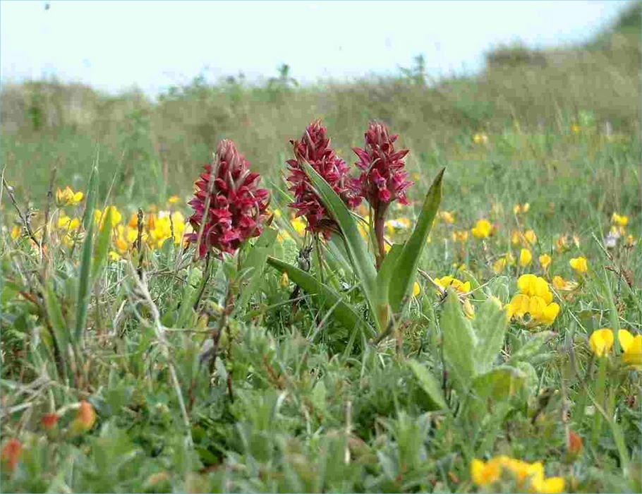
The Hartland coastal plateau rises up to Bursdon Moor, part of the Culm Grassland SAC. Culm grasslands exist in sites untouched by intensive agriculture and land drainage practices and are a rare and fragmented type of purple moor-grass and rush pasture associated with the underlying carboniferous sandstones known as the “culm measures”. Culm grasslands are characterised by tussocks of deciduous Molina grass which gives these sites a pale brown colour in winter and supports a wide variety of flowering plants, such as meadow thistle, heath spotted orchid, bog asphodel, greater bird’s-foot trefoil, water mint and the main larval food plant for Marsh Fritillary butterfly, Devil’s-bit Scabious. Culm grasslands have important roles in holding water in the landscape, reducing peak flow and improving water quality as well as capturing and retaining carbon. Elsewhere, lowland meadows and dry acid grasslands exist in isolated pockets providing a valuable nectar source for pollinators and good foraging sites for bats, kestrels and barn owls. The National Trust are delivering an ambitious project to create new species-rich grasslands across 70 miles of North Devon, much of which will provide connectivity between existing priority habitat within and into the AONB.
Intertidal Mudflats and Coastal Saltmarsh
The mudflats and coastal saltmarsh at The Skern and Crow Point provide vital high tide roosting and foraging habitats to the wintering wildfowl at the mouth of the Taw and Torridge Estuary SSSI supporting nationally important numbers of overwintering Golden Plover, Lapwing and Curlew.
Farming and Land Management
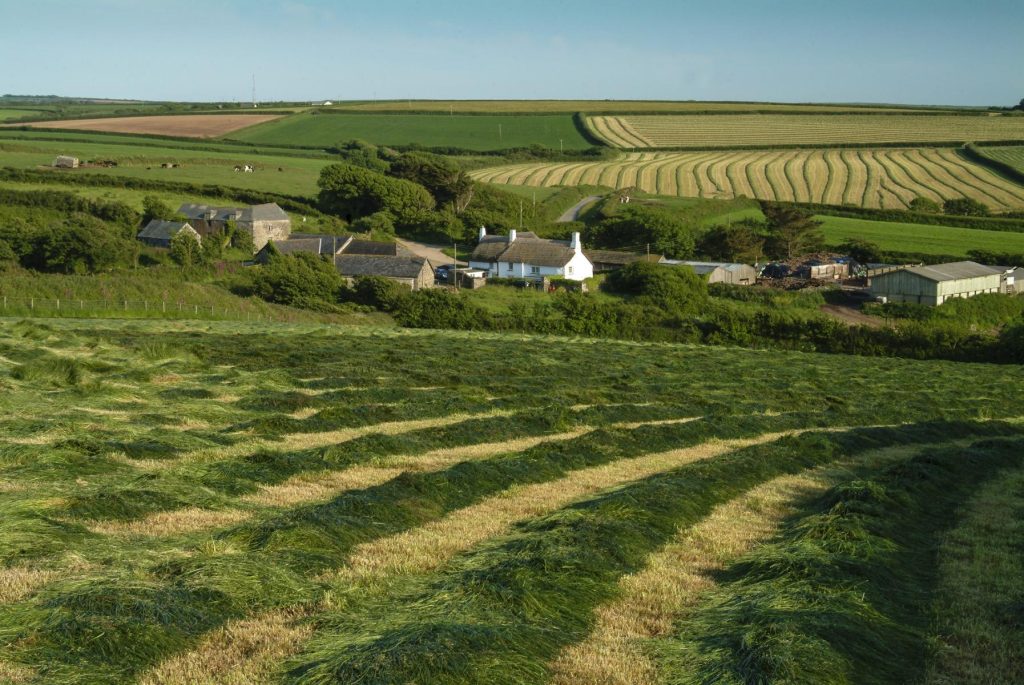
The National Landscape is a farmed landscape reflecting centuries of land management traditions and change. 63% is under agriculture and 41% of the eligible land area is managed in agri-environment schemes. With nearly 180 commercial holdings and an estimated 100 smallholdings, the majority are engaged in livestock farming, 55% lowland grazing and 8% dairy, reflecting the poorer quality of agricultural land. General cropping farms make up an additional 20% of businesses and a handful specialise in poultry, pigs, forestry or horticulture. There are six larger estates within the National Landscape, with the biggest being the National Trust who own around 11% of the area across several large holdings. In contrast there are increasing numbers of small sites under 5 ha being offered for sale and then purchased and managed specifically for wildlife with ponds, orchards, hedgerows, tree planting and wildflower meadows with no commercial farm activity.
The farmed landscape provides an important habitat resource alongside its economic, social and heritage roles. The mosaic of grazed pasture, hedges and woodlands in North Devon support nationally significant populations of Greater Horseshoe bats. Farmland also presents the greatest opportunities to connect, create and expand habitats, and increase canopy cover in the delivery of the Protected Landscapes Targets and Outcomes Framework. Advising and supporting landowners to successfully integrate nature-based solutions with their commercial farm activities will build more resilience into the farmed landscape, for example to better manage water flows on farms and mitigate the impacts of increasing extreme weather events. Optimising take up of agri-environment schemes and grant programmes can support improved hedgerow management or creation of new hedgerows, orchards, woodland and species-rich grasslands to improve the connectivity of fragmented and isolated habitats. Hedgerow trees, in-field trees, copse management and woodland creation schemes will increase the canopy cover of the National Landscape, whilst being sensitive to both Landscape Character Type and farm productivity. Water quality is a high-profile issue on the bathing beaches and surfing areas adjacent to the National Landscape, but the area is not in a nitrate vulnerable zone, does not provide drinking water and is not vulnerable to urban flooding issues (although isolated incidents of flooding have occurred at Hartland). The five water bodies feed into the sea and are mainly of moderate or good quality with occasional small scale sewage overflows or agricultural runoff (Umber and Abbey streams). However, pollution issues within the Taw Torridge estuary do impact on the sandy beaches and inter-tidal habitats, alongside washed in marine litter and beach litter, aggravated by storms and tides.
Nature Outcomes, Drivers for Change and Policies
Nature Outcome
Habitats are protected, created, restored and managed to improve condition, expand and better connect spaces for thriving plants and wildlife.
Policies
B1 Restore, create and manage habitats for wildlife richness and resilience
B2 Address and mitigate impacts of invasive species, disease and climate change
B3 Promote, encourage and support take up of agri-environment schemes and grants to conserve and enhance natural beauty
B4 Support management of landscape features including hedgerows, ponds, woodlands, dunes and streams
B5 Prioritise nature-based solutions to tackle climate change, nature loss, water management and supply.
B6 Support appropriate species management and reintroductions that conserve and enhance the area
Main Drivers for Change
Climate and ecological emergencies
25 Year Environment Plan and legislation
Nature Recovery Plan and Devon Local Nature Recovery Strategy
Development pressure from housing, tourism and land use change
Changes in agriculture and land use
Impacts of invasive species
Access pressures (increased number of people, dogs, new activities)
Pollution, pesticides and insecticides
Uncertainties with agri-environment schemes
Ageing farming population / new entrants
Extreme weather events
Constraints on natural processes
Public concerns and expectations
Soil health and water quality
Nature Aims, Objectives and Measures of Success
Aim
Restore and create more than 1,400 hectares of a range of wildlife-rich habitats, outside protected sites by 2042 (from a 2022 baseline)
Objectives
To support the delivery of actions and targets in the North Devon UNESCO Biosphere Nature Recovery Plan.
To prioritise landscape-scale habitat creation in line with the Devon LNRS to increase habitat connection and facilitate species movement.
Measure of Success
Extent of wildlife rich habitat created, outside of protected sites (PLTOF 1)
Aim
Increase tree and woodland canopy cover by 200 hectares by 2042
Objectives
To use opportunity mapping and LNRS to identify woodland creation priorities, and support access to the England Woodland Creation Offer (EWCO)
To develop a trees and woodland strategy for the National Landscape to ensure that canopy cover is increased following the principles of the Devon Trees and Woodland Strategy – “Right Place Right Tree”; the North Devon and Torridge Joint Landscape Character Assessment and the Devon LNRS.
Measure of Success
Extent of Tree canopy and woodland cover (PLTOF 8 Climate), outside of protected sites (PLTOF 1)
Aim
Achieve 80% of SSSIs are in favourable condition by 2042
Objectives
To seek opportunities to support Natural England’s monitoring of SSSIs to ensure that at least 60% are assessed as having ‘actions on track’ to achieve favourable condition by 31 January 2028.
Measure of Success
% of SSSIs in favourable condition (PLTOF 2)
% of SSSIs assessed as having ‘actions on track’ to achieve favourable condition (PLTOF 3)
Aim
Continuing favourable management of all existing priority habitat already in favourable condition outside of SSSIs (from a 2022 baseline) and increasing to include all newly restored or created habitats through agri-environment schemes by 2042
Objectives
To increase condition monitoring and facilitate the development of site management plans
To identify potential sites and support actions to enable them to meet the published 30×30 criteria
To monitor and support beach cleaning and marine waste removal to protect coastal and inter-tidal habitats and species
Measure of Success
Extent of priority habitat within Protected Landscapes, outside of protected sites, in favourable management through agri-environment schemes (PLTOF 4)
Area contributing to 30×30 criteria
Number of active beach clean groups
Aim
Remove invasive species from priority habitats.
Objectives
To use opportunity mapping and LNRS to prioritise invasive species removal working with partners and landowners
To increase monitoring and training opportunities for landowners.
Measure of Success
Reduction in the distribution and abundance of invasive species.
Aim
Ensuring at least 65% to 80% of land managers adopt nature friendly farming on at least 10% to 15% of their land by 2030
Objectives
To encourage uptake of agri-environment schemes and grant programmes to support nature-friendly farming
To support management of landscape features including hedgerows, ponds, woodlands, dunes and streams
To encourage the use of regenerative agricultural practice through engagement and learning
Measure of Success
% of land managers adopting nature-friendly farming on a percentage of their land (PLTOF 5)
Aim
Improve water quality and flows of coastal streams
Objectives
To work with land managers at catchment scale to implement nature-based solutions to improve water quality and flows increasing landscape resilience.
To support actions to reduce water pollution from agriculture, storm overflows, road run-off and chemicals to benefit nature and people
Measure of Success
% water bodies achieving good status
Aim
Improved water quality and extent of estuarine and inter-tidal habitats
Objectives
To support work with landowners within and in the setting of the National Landscape to reduce ecological and chemical pollution to protect inter-tidal habitats and bathing beaches
Measure of Success
% of bathing waters assessed as excellent
People
Aim
Improve soil health and its conservation
Objectives
To improve soil health and conservation for productive agriculture and carbon storage and sequestration
Measure of Success
Area of land managed for soil health
Nature tourism
Tourism is a vital part of the local economy with visitors drawn to the National Landscape by the stunning beaches, dramatic coastlines, water sports, the South West Coast Path and the tranquillity and dark skies of the Hartland Peninsula and Exmoor fringes. In 2023, the North Devon and Torridge region welcomed around 4.9 million visitors contributing over £350 million, but there has been more than a 10% decline in the number of visitors in the last ten years, and day visits to the coast are down by 25%1. Within the National Landscape itself, despite a temporary boost following the COVID-19 pandemic, overall visitor numbers have continued to fall. There has been a decline in visitor numbers from 2.9m in 2016 to 2.1m in 2023, staying trips have decreased by 25%, day visits by 29% and tourism-supported employment down 25%, with overall spend down by 3% since 20162.
Visit Devon markets the area as ‘England’s Adventure Coast’ with a focus on water sports, walking and beach getaways as well as its high quality and diversity of nature and heritage with a National Landscape and Exmoor National Park. This has been enhanced by the status of World Surfing Reserve covering 30km of North Devon’s coastline including five surfing beaches from Saunton to Lynmouth. Announced in 2022 and overseen by a Local Stewardship Council, it is the twelfth reserve in the world designated by the international group ‘Save the Waves’ and the only cold water reserve with many of the best waves arriving in the winter season, contributing to year-round tourism spend. The increasing focus on nature based tourism is a positive attempt to value the high quality natural environment, increase access and opportunities for all, and engage businesses and visitors with nature and landscape to encourage them to care for it whilst enjoying themselves. A partnership between the Biosphere and district councils has supported a Nature Tourism officer to deliver this work across the whole Biosphere. However, there is great diversity in the visitor population reflecting historical tourism flows, a wide range of visitor accommodation types and changing activity trends among visitors and service providers. North Devon’s coast provides both high end and budget opportunities for those wishing to enjoy the area. This presents a challenge to agencies including the National Landscape Partnership to provide appropriate messages and use a range of communication methods to reach as wide an audience as possible through social media, traditional media, business communications and on-site information.
Access, recreation, health and wellbeing
The North Devon coast is challenging to access given the high sea cliffs, high tidal range, rocky shores, single track roads, lack of public transport and hilly terrain. However the benefits are enormous from both the scenic beauty and the network of paths, open access land and opportunities for sport and recreation. The National Landscape has 207km of Public Rights of Way, plus the 90km of the South West Coast Path which has become part of the new King Charles III England Coast Path which provides considerable economic value to the area. The South West Coast Path is one of the most popular National Trails in England, and this can lead to direct and indirect impacts on the local environment arising from transport, visitor and tourism business pressures.
The 935 hectares of ‘Open Access’ land, as defined under the CRoW Act, covers just over 5% of the total area within the National Landscape, much of it along the coast path and including the wide sandy beaches found from Westward Ho! through Saunton, Croyde, Woolacombe and smaller beaches along to Combe Martin. North Devon is known for its water sports particularly surfing, however other water sports such as kayaking, coasteering, paddle boarding and wild swimming have become increasingly popular and reaching previously inaccessible or less visited sites. All of these have the potential to connect more people with nature and for them to benefit from these green and blue spaces, but careful management is required to avoid activities impacting negatively on habitats, species and protected sites.
Although there has been a range of works and projects over the years to improve access for people with varying physical abilities or mobility issues, the more recent trend is to take a broader health and wellbeing approach. This has increased attention on the potential of protected landscapes to contribute to the health and wellbeing of resident and visiting populations. Evidence of the value of being in or just looking at natural environments, particularly green and blue environments, for both physical and mental health is growing. In response, National Landscape Partnership members have broadened out and customised their activities to meet the needs of very different groups within the population. This can range from targeting children in local schools who have never been to the beach, outdoor activities for Afghan and Ukrainian refugees settling in North Devon, offering artistic activities linked to the natural environment to engage people not usually interested in the environment, organising non-competitive physical activities and celebrations, and using special interests to stimulate exploration and activities in the countryside (history, art, music, literature, film).
Community
The National Landscape designation and the associated high quality environment offers many positive aspects for residents, businesses and visitors. As a landscape of national importance it is essential to optimise the benefits of visiting, living or working in the area and make it accessible to all whilst conserving and enhancing natural beauty. However, as a remote rural area with a population of just under 10,000, local communities face challenges in terms of infrastructure capacity, maintaining local facilities and services, a low wage economy overly dependent on agriculture and tourism, high house prices and rents, limited public transport, sparse public EV charging network, and pressures from some two to three million visitors a year. The community-based priorities for this Plan are providing opportunities to welcome everyone to enjoy and experience the area, to identify, understand and address the barriers to experiencing the National Landscape and to positively engage with new communities. Additionally, experiencing the National Landscape can be an important opportunity to increase understanding of nature and climate, and thereby inspire behaviour change to address the climate and nature emergencies.
Providing opportunities to gain experience, to learn and to volunteer are important priorities alongside nature connections, citizen science and outdoor experiences. Established programs delivered by partners provide long-standing and well-developed opportunities engagement in the NDCNL including the work of Torridge District Council, The National Trust, Earth Action North Devon and other charities. These actions are bolstered through the activities of National Landscape partner organisations and numerous externally funded projects, for example Finding Nature’s Footprints, Connect 2 Nature at Braunton Countryside Centre and the Biosphere’s Pledge for Nature and Biosphere Communities projects. The National Landscape’s small grant scheme (the Sustainable Development Fund) provides small grants to support community facilities and services, reducing barriers to accessing the coast and countryside, and actions for nature and heritage conservation. Using a wide range of communication techniques is essential to reach different audiences from websites and social media to posters, traditional media, leaflets and noticeboards.
People Outcomes, Drivers for Change and Policies
People Outcome
Everyone is welcome and can safely access the areas to enjoy, connect with, contribute to and understand this landscape designated as outstanding for the nation.
Policies
C1 Support nature tourism activities that minimise adverse effects on nature, natural beauty and climate
C2 Improve physical accessibility and outdoor activities supported by active travel infrastructure
C3 Promote use of green and blue spaces for better connection to landscape, heritage and nature to improve human health and wellbeing
C4 Address and monitor equality, diversity and inclusion across all activities
C5 Value and involve communities and visitors with landscape, nature and cultural heritage through volunteering, events and training
C6 Support communities, visitors and businesses to change behaviour to transition to net zero
Main Drivers for Change
Year-round visitor economy – pressures and opportunities
Bathing water quality of public concern
Extreme weather effect on bookings, length of stay and activity viability
Value of the National Landscape special qualities for physical and mental wellbeing
Accessibility issues – physical & social
Human impacts – dogs, numbers, behaviours, expectations
Equality, diversity and inclusion
Behaviour change for nature and climate
Social media as an information source
Lack of public transport
High cost of accessing the coast
People Aims, Objectives and Measures of Success
Aim
A sustainable, year-round and diverse visitor economy will be based on the natural beauty of the area.
Objectives
To support the North Devon and Torridge Nature Tourism programme, working with businesses and visitors to conserve and enhance natural resources, dark skies and water quality
To review, update and rebrand visitor information and interpretation materials on site and in digital form by 2030
To support campaigns with tourism businesses and visitors for behaviour change in relation to climate, nature and sustainability
To promote the Countryside Code and dog management policies
To increase understanding of local land management, farming and food production among visitors, young people and children
Measure of Success
Number of new and rebranded signs with digital links.
Number of visitor campaigns
Number of engagement events
Aim
Recreation and physical and social access across the areas will be enhanced and communicated to improve opportunities, inclusion and safety.
Objectives
To promote and maintain the extensive public rights of way and open access land, alongside promoting responsible public access through promotion of the Countryside Code
To improve understanding of barriers to under-represented groups (e.g. children, young people, refugees, people with disabilities (physical and unseen)) and identify actions to make areas and opportunities more accessible by 2026
To carry out practical works to improve accessibility such as parking, surfacing, signage and equipment and where appropriate extend the network of accessible routes.
To support a wide range of activities to reach a wider range of audiences (e.g. green and blue space access, citizen science, cultural heritage, arts, nature connection and community/ voluntary sector led initiatives)
To improve active travel and accessible transport into and around the NL
Measure of Success
Access audit and strategy
Access for All indicators (PLTOF 9)
Number of people participating in activities
Aim
Residents and visitors will be informed, connected and active in meeting the purpose of the National Landscape
Objectives
To raise awareness and understanding of the National Landscape, through interpretation, promotion and cultural events
To develop opportunities annually for volunteering and training to gain skills and knowledge of benefit to the NL
To support communities and businesses to reduce greenhouse gas emissions (GGE) to Net Zero by 2050 by making changes to their behaviours
To set up processes to improve and monitor diversity and inclusion in the team, Partnership and volunteers to better represent the wider community by 2026
Measure of Success
Number of people engaged with the NL
GGE reductions (PLTOF 6 climate)
Number of people volunteering / trained
Grants take-up
Annual monitoring for EDI across all activities
Partnership and Management
The governance arrangements for the National Landscape were established in 2006 under the guidance of the former Countryside Agency. Since 2011, Defra has provided direct funding to the host authority (Devon County Council) to support the review and oversight of the Management Plan and coordination of the Partnership and staff team. This funding covers 75% of the core running costs, the remaining 25% coming from the three local authorities covering the National Landscape. In 2024 as well as the core activities expected of a National Landscape team, Defra set non-statutory targets for every protected landscape area in England to deliver goals in the Environmental Improvement Plan 2023 through the Protected Landscapes Targets and Outcomes Framework. These have been incorporated into the Management Plan. Local governance arrangements are specified in a Memorandum of Agreement between the three Local Authorities.
The North Devon Coast National Landscape Partnership
The Partnership is a voluntary, non-executive body with Terms of Reference and a Code of Conduct which meets three times a year to review the Management Plan, oversee delivery of the Plan, champion the National Landscape, provide advice and guide work within the area, convene and collaborate to implement the Plan’s aims and targets. The Partnership has sub-groups overseeing key areas of work such as planning, SDF grant allocations and communications. The Partnership is comprised of representatives from:
Members
Coastwise North Devon
Country, Land and Business Association
Campaign to Protect Rural England (Devon)
Devon Wildlife Trust
Environment Agency
Exmoor National Park Authority
Forestry Commission
Historic England
National Farmers Union
National Trust Natural England
Natural England
North Devon Archaeological Society
North Devon UNESCO Biosphere Partnership
North Devon World Surfing Reserve
Earth Action North Devon
Tarka Country Trust
Taw Torridge Estuary Forum
Devon County Council
North Devon Council
Torridge District Council
2 Parish Council representatives
Up to 8 Community representatives
The Executive Group
The Executive group is comprised of the Chair, Vice Chair, Manager, representatives of the funding partners and Natural England meets four times a year to oversee day-to-day management issues and monitor delivery of the annual business plan for the team. Devon County Council is the host authority employing the team and providing office services in Barnstaple.
The National Landscape Team
The team is composed of a Manager, National Landscape Officer and a People and Place Officer (2.6 FTE roles). The Team provides: administrative support and reporting to the governance structures; planning and development advice to the local planning authorities; promotion, awareness raising and engagement activities about and in the National Landscape; administration of grant programmes; project development and external funding bids; partnership working and engagement at the local, regional and national level including participation in the National Landscapes Association, Devon Landscape Policy Group and the Devon Protected Landscapes Managers’ Forum.
The National Landscapes Association
The North Devon Coast National Landscape is a member of the National Landscapes Association a registered charity with the mission to ‘Lead and champion activity, working with National Landscapes, to protect and restore the UK’s most outstanding landscapes and make sure everyone can enjoy them’. The Association provides learning, support and collaboration across the 46 members in the UK through a core team, online intranet, joint marketing activities, national meetings and an annual conference.
Delivery and Monitoring
Delivery
The aims and objectives set out in the plan are to conserve and enhance the North Devon Coast National Landscape. Delivery of these ambitions will require the combined effort of the relevant authorities, the National Landscape Partnership, Landowners, communities, members of the public and the National Landscape team. The Strategic Delivery Plan is a key part of the Management Plan and can be found in the appendices. It outlines the strategic high-level actions over the five-year period required to deliver the Management Plan’s ambitions across Place, Nature, People, Climate, Equality, Diversity and Inclusion, based on the aims and objectives set out in earlier sections of this plan.
It has been included separately in the appendices to enable it to be updated more readily through the plan period.
Monitoring
There are two types of measures of success in this Plan, those related to national targets and national data sets monitored by Natural England through the Protected Landscapes Targets and Outcomes Framework and those reported on or measured locally to report on achievement of Objectives. Some data has longstanding baselines and others have only been produced in the last few years. In terms of reporting to the Partnership and the wider public, this is done through several different approaches: the five-yearly State of the National Landscape report, the National Landscape Review produced every other year and reporting three times a year to the National Landscape Partnership. It should be noted that monitoring data for all of the PLTOF targets and some of the local targets relies on government agencies to produce and update national data sets and this is outside the control of the team and Partnership. A summary of the data gathered by the National Landscape Team can be seen in Appendix C.
Protected Landscapes Targets and Outcomes Framework (PLTOF)
Target: Restore or create more than 1,400 hectares of a range of wildlife-rich habitats within the North Devon Coast National Landscape, outside protected sites by 2042 (from a 2022 baseline). Indicator: Extent of wildlife rich habitat created or restored within Protected Landscapes, outside of protected sites
Target: 80 % of SSSIs within Protected Landscapes in favourable condition by 2042 Indicator: % of SSSIs within Protected Landscapes in favourable condition
Target: For 60% of SSSIs within Protected Landscapes assessed as having ‘actions on track’ to achieve favourable condition by 31 January 2028 Indicator: % of SSSIs within Protected Landscapes assessed as having ‘actions on track’ to achieve favourable condition
Target: Continuing favourable management of all existing priority habitat already in favourable condition outside of SSSIs (from a 2022 baseline) and increasing to include all newly restored or created habitats through agri-environmental schemes by 2042 Indicator: Extent of priority habitat within Protected Landscapes, outside of protected sites, in favourable management through agri-environment schemes
Target: Ensuring at least 65% to 80% of land managers adopt nature friendly farming on at least 10% to 15% of their land by 2030 Indicator: % of land managers adopting nature-friendly farming on a percentage of their land
Target: Reduce net greenhouse gas emissions in Protected Landscapes to net zero by 2050 relative to 1990 levels Indicator: The level of greenhouse gas emissions within Protected Landscapes
Target: Restore approximately 130,000 hectares of peat in Protected Landscapes by 2050. Not applicable to North Devon Coast NL due to lack of deep peat soils. Indicator: Extent of peat under restoration in Protected Landscapes
Target: Increase tree canopy and woodland cover by 200ha of total land area in the North Devon Coast National Landscape by 2050 (from 2022 baseline). Indicator: Extent of tree canopy and woodland cover in Protected Landscapes
Target: Improve and promote accessibility to and engagement with Protected Landscapes for all using existing metrics in our Access for All programme Indicator: Metres of accessible path as a percentage of total path Number of accessible toilets and rest stops Number of disability accessible parking spaces Number of accessible gates and gaps Number of visits and volunteer days facilitated by new equipment Number of schools engaged (primary and secondary) both inside and outside the Protected Landscape boundary Number of volunteer days Number of accessible or easy access routes for which wayfinding has been created or improved Policies in place to ensure Protected Landscapes are taking positive action to widen the diversity of their staff, boards and volunteers
Target: Decrease the number of nationally designated heritage assets in Protected Landscapes to be deemed at risk Indicator: Number and % of nationally designated heritage assets in Protected Landscapes to be deemed at risk. To separately cover the categories of:
scheduled monuments
registered parks and gardens
registered battlefields
listed buildings (grade I or II*)
protected wreck sites
Glossary
Affordable Housing
Housing for sale or rent, for those whose needs are not met by the market
Area of Outstanding Natural Beauty (AONB)
An area of high scenic quality which has statutory protection in order to conserve and enhance the natural beauty of its landscape.
Biodiversity
The variety and variability of life on Earth measured at the genetic, species or ecosystem level. Includes wildlife and flora.
Biodiversity Net Gain
An approach and policy that seeks a net gain for biodiversity on a development site or through provision on an alternative site, with an overall objective to address the significant species loss recorded in the UK.
Conservation Area
An area of special architectural or historic interest, the character of which it is desirable to conserve.
Countryside and Rights of Way Act 2000
This Act provides for public access on foot to certain types of land, amends the law relating to public rights of way, increases measures for the management and protection for Sites of Special Scientific Interest, strengthens wildlife enforcement legislation and provides for better management of Areas of Outstanding Natural Beauty.
County Wildlife Site (CWS)
Sites of significant wildlife value from a county perspective.
Culm Grassland
Damp unimproved grasslands that are found overlying the Culm Measures of North Devon and North East Cornwall.
Ecosystem services
The benefits that humans freely gain from the natural environment (see Natural Capital).
ELMS
The Environmental Land Management Scheme is a government programme that provides financial incentives and support to landowners. It encourages changes to land management practices that provide environmental benefits.
SFI
Sustainable Farming Incentive is a component of ELMS providing financial incentives to farmers who implement practices that improve soil health, enhance biodiversity, and contribute to climate change mitigation.
Greenhouse Gas Emissions
Gases such as carbon dioxide and methane released into the atmosphere by human activity that contribute to climate change through the greenhouse effect. They are primarily produced from burning fossil fuels, industry and land use change.
Historic Environment
All aspects of the environment resulting from the interaction between people and places through time, including all surviving physical remains of past human activity, whether visible, buried or submerged, and landscaped and planted or managed flora.
Heritage Coast
Stretches of undeveloped coast, defined by local authorities, for their outstanding scenic value where resolution of conflicts is needed between recreation, conservation, access and agriculture.
Landscape
The visible features of an area of land including physical landforms, water bodies, vegetation, land use, buildings, structures and transitory elements such as lighting and weather conditions.
Landscape Character Assessment (LCA)
A tool used to understand and articulate the character of the landscape, identifying sense of place and distinctions between areas.
Landscape Character Type (LCT)
Distinct types of landscape which are generic in character and share similar combinations of geology, landform, vegetation and land use.
Landscape Resilience
Creating healthy and adaptable landscapes for species and people by developing core areas and networks that support climate adaptation and deliver ecosystem benefits.
Listed Building
A building of notable architectural or historic interest listed by the Secretary of State under the Planning Act 1990. Buildings must be at least 30 years old.
Local Nature Recovery Strategy (LNRS)
A strategy that agrees priorities for nature recovery and proposes actions in locations where they will have greatest impact.
Local Nature Reserve
Land owned or controlled by local authorities that is protected for its nature conservation value.
Local Housing Needs
The scale, type, size and tenure of housing needed in a settlement, including affordable housing, and the wider area it serves.
National Landscape
The national rebrand of Areas of Outstanding Natural Beauty in 2023 to highlight their national significance, while retaining the AONB legal designation.
Natural Capital
The parts of the natural environment that produce value to people, such as water, soil and wildlife, delivering ecosystem services.
Nature Based Solutions
The use of natural processes to reduce flood and erosion risk, such as woodland planting or hedge banks, rather than hard defences.
Protected Landscapes Targets and Outcomes Framework (PLTOF)
Non-statutory targets set by government to deliver Environmental Improvement Plan goals within Protected Landscapes.
Public Rights of Way
Public footpaths, bridleways and cycleways along which the public has the right to travel.
Scheduled Monument
A designation providing state protection to nationally important archaeological sites and monuments.
Seascape
The complex interrelationship between landforms, coast and sea within a landscape.
Shoreline Management Plan
A document providing strategic guidance on coastal management for authorities, landowners and communities.
Sites of Special Scientific Interest (SSSI)
Areas designated, protected and monitored by Natural England for their flora, fauna or geological value.
Special Areas of Conservation (SAC)
Areas designated and protected under the EU Habitats Directive.
Special Qualities
The aspects of an AONB considered most important and on which management priorities are based.
Strategic Environmental Assessment (SEA)
A process to identify, assess and mitigate significant environmental effects of policies, plans and programmes.
Sustainable Development Fund (SDF)
A small grant scheme administered by the National Landscape team to help deliver Management Plan policies.
Appendix A
North Devon Coast National Landscape Priorities for Nature Recovery
The North Devon Coast National Landscape are a committed delivery partner of the North Devon Biosphere Nature Recovery Plan. By working as part of the Biosphere partnership we are able to contribute at a much larger, ecologically effective and strategic landscape scale than would be possible within the confines of the National Landscape boundary. The table below identifies the actions from the North Devon Biosphere Nature Recovery Plan to be delivered within the National Landscape and therefore are priorities for delivery by the North Devon Coast National Landscape Partnership.
The North Devon Biosphere Nature Recovery Plan includes five action plans which details the priorities for key land types in the Biosphere. There are priorities for the National Landscape within each action plan:
Grassland and Arable
Wetlands and Waterbodies
Coasts
Towns and Villages
Trees, Woodlands and Hedges
Where appropriate, an indicative proportional target for delivery within the National Landscape is included and how this action will contribute to delivery of PLTOFs
Appendix B
North Devon Coast National Landscape Delivery Plan 2026-2031
Appendix C
Local Indicator
Landscape Change – Fixed Post Photography
Baseline
2010
Measure
Images
Local Indicator
Powerlines undergrounded – National Grid
Baseline
2019
Measure
Km
Local Indicator
Planning applications responded to
Baseline
2010
Measure
Number
Local Indicator
Pre-applications responded to
Baseline
2015
Measure
Number
Local Indicator
Planning decisions matching NL recommendation
Baseline
2020
Measure
%
Local Indicator
Planning decisions not matching NL recommendation
Baseline
2020
Measure
%
Local Indicator
Heritage assets enhanced
Baseline
2019
Measure
Number
Local Indicator
Heritage volunteers
Baseline
2019
Measure
Number
Local Indicator
Active beach clean groups
Baseline
2015
Measure
Number
Local Indicator
Invasive species removed
Baseline
2025
Measure
Hectares
Local Indicator
Interpretation signs rebranded with digital link
Baseline
2023
Measure
%
Local Indicator
Visitor awareness campaigns
Baseline
2019
Measure
Number
Local Indicator
NL Engagement events
Baseline
2015
Measure
Number
Local Indicator
Access audits
Baseline
2025
Measure
Number
Local Indicator
New audiences engaged
Baseline
2024
Measure
Number
Local Indicator
People engaged with NL through media
Baseline
2016
Measure
Number
Local Indicator
People volunteered with NL
Baseline
2016
Measure
Number
Local Indicator
People trained by NL
Baseline
2016
Measure
Number
Local Indicator
Grants allocated by NL
Baseline
2015
Measure
Number
Local Indicator
Value of grants allocated by NL
Baseline
2015
Measure
Number
References
North Devon and Torridge Tourism Trends, SWRC 2025 ↩︎
North Devon Coast National Landscape Tourism Trends (9 parishes) 2016-2023, SWRC 2025 ↩︎